Actually.... with regards to
yesterday's post, I found a route that can easily be stitched together that does a pretty good job of replicating the yellow portion that I drew in by hand on this map:

Let's recap; the actual Highline Trail consists of the dark and medium orange sections of the map. If you look at the topography and terrain of the region, you'll see that the dark orange actually does not closely resemble the medium orange section--it's not really the high, rugged, alpine region that starts at Leidy Peak and continues westward for the bulk of the Highline Trail. Also, the western terminus of the trail (the western end of the medium orange section) is somewhat arbitrary, since the Uintas themselves continue all the way to Kamas, and the terrain in the western section is similar to that crossed by the Highline Trail itself. The former problem isn't a big deal, since there are trailheads you can use to jump on to the trail right about where the dark and medium orange meet (the Hacking No 1 Lake, also known as Leidy Peak trailhead is perfect, for instance).
One of these days, I'll buy two more Trails Illustrated maps (my go-to sources for the area)--the Flaming Gorge and Eastern Uintas one (
704) and the Dinosaur National Monument one (
220) so I can come up with an eastern extension of the Highline Trail, for a full and complete Uintas Traverse. But for now, I pulled out my
711 (High Uintas Wilderness) and
709 (Wasatch Front North) and looked over the western extension that I had kind of "penciled" in in yellow above. Two things became immediately apparent: 1) there wasn't nearly as much of a private land problem as I thought barring the route to Kamas; other than about four miles of roadwalking at the very end on the way into town itself, you could do all of it, mostly on developed forest service trails, since the Wasatch-Cache National Forest extends almost all the way to the end of the range in the Kamas valley. And 2) existing trails make a pretty nice route through the area that very closely parallels my own yellow line. You can make it a little bit longer or shorter to taste, depending on whether or not you want to take a few slightly longer loops to get closer views to some scenic lake or mountain, and you can also get slightly more direct by taking a handful of rather short cross-country short cuts, but mostly trails
already exist that give a great western extension to the Highline Trail, so that you can have a true Uintas traverse starting at the wrinkled terrain area shown above at Leidy Peak. I imagine that it' would be a good two nights out to cross this section, more likely three (depending on how early in the day you reach the Mirror Lake Highway, assuming that you've already been thru-hiking the Highline Trail from the east.) Here's how I would do it:
- When you reach the western terminus of the Highline Trail (after having hiked it east to west) go through the parking lot and roadwalk about half a mile up SR-150 to the Ruth Lake TH.
- Take the Ruth Lake Trail 092. There are two options;
- you can do a slightly shorter route by turning on trail 158 to the south, or
- you can take a slightly longer but more scenic route by continuing on 092 up to Lofty Lake and beyond, around Mount Marsell.
- A third more direct option is to not go to the Ruth Lake TH at all, but cut cross country nearly directly west from the Highline TH to Scout Lake and from there connect to 158 South. Ruth and Lofty Lakes are regarded as scenic highpoints of the western Uintas region, though, so it seems a shame to miss them just to save an hour or two of walking. I have no idea if the cross-country shortcut is actually faster either; many times it's faster and easier to go longer on a trail rather than beat your way through brush or deadfall or other difficult terrain.
- Turn on 079 heading NW to the 090.7 Junction (which you will take, heading SSW.)
- Turn on 081 South through the notch of Notch Mountain. Here again, you have a few options depending on how direct you want to be:
- Take 081 south all the way to the Crystal Lake TH.
- Turn nearly due west cross country for about a quarter mile after coming through the notch, heading around the north side of the Twin Lakes and to Clyde Lake. There, catch the trail and walk right by scenic Mount Watson. Either way, you'll end up at Crystal Lake TH.
- Take Trail 066 west to the Lakes Country area.
- Turn west (left) on the un-numbered trail (at least according to the TI maps) past Island Lake heading towards Big Elk Lake.
- Turn left (north at Big Elk Lake towards South Erickson Lake.
- Take the Upper Setting Trail (156) to the camping area.
- Roadwalk or cut cross country to the other side of the camping/parking area. It's about a mile of road, but would be less if you go directly across. At the western edge of the camping area is trail 063 at Castle Lake.
- Take 063 starting at Castle Lake to the Yellow Pine TH. This is where you should have your car.
- If you're ultra uptight and nitpickety about traversing the entire area, you could instead from this point on roadwalk about three quarters of a mile from the trailhead to the Mirror Lake Highway, and then roadwalk the last 3-4 miles of the highway into town in Kamas. I wouldn't bother; as far as I'm concerned, the Yellow Pine trailhead is a great place to start (or end) a western extension of the Highline Trail.
Here's a few pictures of some of the stuff you'll see on this extension:
 |
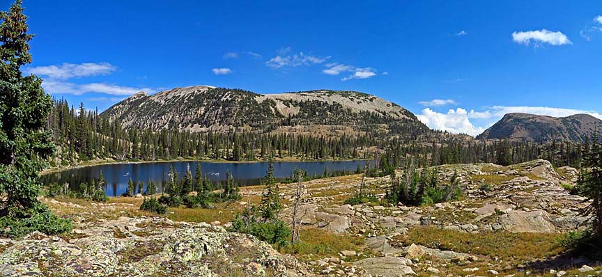
| Lofty Lake and Mount Marsell, near the beginning of the extension (if westbound) |
 |
| Notch Mountain from Ibantik Lake |
 |
| Clyde Lake and Mount Watson |
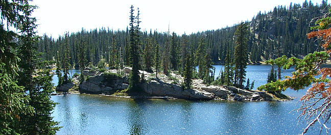 |
| Island Lake at the end of the Lakes Country area |
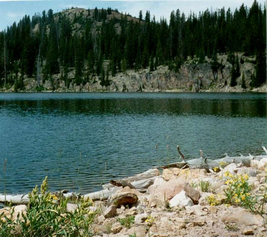 |
| Castle Peak from Castle Lake |

No comments:
Post a Comment