An interesting aside: I'm driving from SE Michigan, where I live, to Vernal, UT where my sister-in-law lives, and which will serve as a "base-camp" for my foray in the High Uintas Wilderness. I really dislike driving on Interstates. They're busy, crowded, and boring. Whenever I can, if it's reasonable, I like to duck off of interstates and drive on some other type of road. While small two-lane roads may seem slower, they often have so much less traffic that you don't necessarily make worse time. While getting to central Nebraska pretty much requires driving non-stop on interstates--I-80 mostly, but also some I-94 between Detroit and Chicago--it's not hard to avoid much of the interstate travel other than that, and get much more relaxed and even scenic drives for what will be my second day (of two) of driving to Vernal and my first day (of two) of driving back home can be spent mostly on other roads, which I'll enjoy quite a bit. Here's the plan for North Platte, NE to Vernal first, followed by the plan from Vernal to Omaha.
Head west for just a little bit until you get to Ogallala. I actually hoped to stay in Ogallala for the first night, but I couldn't get a place. But this is a short hop, done very early in the morning (I'll start before sunrise) and then I get off and take little US-26 up towards Gering and Scottsbluff. This is a nice drive, with a scenic overlook on Lake McConaughy, up past Ancient Ruins Bluffs, a stop at Chimney Rock, and then an exploration of Scott's Bluff National Monument.
After spending no more than an hour to an hour and a half there, head out of town south on 71, turn west on 88, and then turn southwest again on 85 which takes us into Cheyenne. Not only is this a scenic and interesting little aside, but it's a very nice, smooth drive; when I did it last year, I hardly saw any other traffic on the road at all. It was relaxed and the happiest part of my entire driving experience (which isn't ever going to be as fun as my hiking experience, but still.)
I've got to bear another couple of hours of I-80 after getting to Cheyenne, but at Rock Springs I can head south on 191, which is a great scenic drive through Flaming Gorge National Recreation Area and the eastern end of the Uintas, before coming back down again into Vernal.
On the way back home, rather than going back north to Rock Springs, I'm going to head directly east on US-40. Take this quite a ways; just past Steamboat Springs, actually, then turn northeastish on 14. This will give me the extremely scenic North Park-Cache le Poudre route into Fort Colllins. Staying on 14 after exiting the mountains will take me directly east where I'll eventually combine with I-76 which angles upwards to join I-80 not far from Ogallala, actually. This way, I get to avoid interstates for most of two (out of four) driving days, and in fact even specifically get to visit some scenic byways while I'm at it.
I'm quite excited, actually, that I've managed to come across this. It was a pure accident of noodling over a road atlas and noticing that I'm not really going very far out of my way to do it this way. And no doubt I'll really enjoy the driving experience that much more.
I'll still have the same Ogallala-Detroit interstate experience--twice, both west and eastbound--but that's tolerable. I'll survive.

Friday, May 22, 2015
Wednesday, May 20, 2015
Gear
Should have a shipment from Amazon, hopefully arriving today, which will complete the penultimate gathering of gear for my hike. The only thing(s) left to pick up following the arrival of this package is another permethrin bottle, a fuel canister, and my food. We're about done. How did we do?
- I got a free pack. A friend of mine was having a garage sale, and had stumbled across one that he called me and asked me if I wanted before he sold it. It's not the perfect pack, and probably not what I'd have bought if I were to buy one. It's a big bigger and heavier both than I'd prefer. But it'll do, and it's free. And I'll mostly only use it when I have someone with me who's using the other pack, which I like better. I can't even remember what brand it is so I can look it up and try and figure out its capacity, but it looks like probably some local off-brand pack, and it looks bigger than my 50L. I'm guessing it's probably about a 65L or so.
- I have another sleeping bag. It's bigger and heavier than the one I already was using, but then again, I wasn't very warm last year either. Since my wife is very worried about my very skinny 13 year old son being cold at night, I'm willing to put up with an extra pound or two to carry a sleeping bag that makes her more comfortable... even if it doesn't do much for me. And may or may not do much for him; don't know yet. He actually doesn't appear to sleep very cold, honestly, in spite of his very wiry frame. He does get cold when swimming easily, though, so who knows.
- I wasn't going to do anything with any kind of stove or cooking and go with cold, no-prep food. However, since I'm hoping to piggy-back off of this trip to get my son the Backpacking and Hiking merit badges, I had to look up the requirements for both, and... you guess it, you have to actually do the following, so I bought one:
- Explain the advantages and disadvantages of different types of backpacking stoves using at least three different types of fuel.
- Demonstrate that you know how to operate a backpacking stove safely and to handle liquid fuel safely.
- Prepare at least three meals using a stove and fuel you can carry in a backpack.
- Once everything is fully packed and ready to go, I'll post a picture of my gear, like I did last year. I'll probably weigh in again too, although I expect bad news in this regard; I'm bringing a few more things and bringing a few heavier things. The only saving grace is that I'll be able to share some of the load; we only have one tent between us, for example, and only one stove.
Wednesday, May 13, 2015
2016 and 2017
I haven't done my big 2015 hike yet (counting down the weeks, though, and soon days!) but I'm giving some thought to what to do for the next year or two. This isn't urgent, but it's fun, so what the heck. I've already posted a big list of hikes that are high on my "want" list, but this is a very different kind of post; what I'm a most likely to actually do next?
First off; let me just say that although there are lots of destinations left in the Uintas that I want to see, I want to break from them and do something else. But just for the sake of completion and because I like lists, here's the highpoints of what I still want to do:
First off; let me just say that although there are lots of destinations left in the Uintas that I want to see, I want to break from them and do something else. But just for the sake of completion and because I like lists, here's the highpoints of what I still want to do:
- Middle, West and Amethyst basins as a single trip, about a week, about 4 days.
- See Naturalist and Rock Creek basins a bit more. 3 days.
- Allsop and Priord Lakes basins. 2-3 days.
- Henry's Fork Basin and Kings Peak summit. 2-3 days.
- "Western Uintas" including Notch Mountain, Ibantek Lake, etc. 2 days, probably.
That's probably two more trips, where I can combine bullet points there and see it all in another two summers, assuming my backpacking trips remain somewhere between a week and two weeks, like they most likely will. But again; I'm ready to try something new.
Constraints: I've already got some plans for next year that I have to work around. I'll have to take the week around July 4th off again, and will probably use that for a family trip with my folks and my son. My older son comes back from Ecuador and then he and my daughter will be off for college. Although my wife is much more likely to take them and leave me to ferry the younger boys to and from their various destinations here locally, we are planning a big family trip--probably another week--in late July or early August. This means that I've only got two weeks of vacation left to play with, and that presumes nothing else comes up that would warrant me spending time off, and it also means that much of July and August is already booked, and I can't have two consecutive vacations, I'm afraid. That leaves me looking at either shoulder seasons, or somewhere where the hiking season is not quite the same as your typical Rocky Mountain destination.
Actually, a mid-September trip with golden aspens sounds really fun. So that's a possibility. Otherwise, I'm looking at trying my hand at a desert trip, which I haven't done for a while.
Here's the round-up of potential trips that I'd be more or less likely to do for 2016.
- Try out Cortez, Colorado. I can see Mesa Verde for a couple of days, and then head into the La Plata Mountains, which are nearby. This would probably best be done in September.
- The Four Pass Loop in the Maroon Bells-Snowmass Wilderness outside Aspen, CO. This would again have to be a September trip.
- I could also potentially see a bunch of Wasatch Mountain destinations in Utah in September. I could even crash in between destinations with family or friends, possibly--this is the least wildernessy experience of them all, but it has its attractions. I could get to Lake Blanche, I could summit Timpanogos, I could summit maybe Mount Olympus, or at least explore it, I could summit Mount Nebo, etc. This could also be combined with any number of other Utah day-hiking or shorter trip destinations; I could explore the La Sals or the Henrys while I'm at it too. This has a lot of attractions, but would likely be the most expensive option, because it would involve more driving around and more nights in hotels, most likely.
- If I get a really early start on things, I could do Big Bend National Park in February. I doubt I'll be ready to roll again that early, but you never know.
- I could also go in March and/or April to various desert or semi-desert locations -- the Grand Canyon, Coyote Gulch + some Arches or Canyonlands stuff or Palo Duro Canyon + Caprock Canyon. This could also be done in the fall; October or even November.
- An October traverse of the Roans Highland section of the AT, plus some exploration of Shining Rock Wilderness would be a major change of pace from the Rockies, and would be fun. And the timing isn't bad for me in 2016.
Of that list, the September mountain trips are the most appealing to me, but again, timing might be tricky. Second are the March/April or October/November desert trips.
In 2017, I may have other constraints that I don't know of yet, but with two kids going to school in Eastern Idaho (most likely) that opens up the opportunity to take advantage of a visit to them to also hit up the Shoals Loop in the Gros Ventre Mountains and the Teton Crest Trail, another very highly desired destination of mine.
Monday, May 11, 2015
Some more trip details
I've been playing around more with caltopo--what a great tool!--and I have some more information available on my trip now, including much more precise mileage and elevation gain. What I've shown is gross elevation gain, because that's how much I have to actually climb; this isn't to indicate that I'm going to end the trip 10k feet or so above where I start, because that would be ridiculous. It does mean that if the elevation shows 10k feet, however, that I'll be climbing that many feet, along with dropping at various points to. Considering that I'm hiking a loop, over the course of the entire trip, needless to say, I'll have a net elevation gain (and loss, for that matter) of 0'.
Anyway, here's some stats for the trip:
Day -1: A bit of hiking as a break between driving at Scott's Bluff National Park. I didn't measure a mileage for going out to Chimney Rock which is also nearby and which I'll also do, but hiking from the visitor's center to the top of Scott's Bluff gives the following:
- Mileage: 1.2
- Gross elevation gain: 535'
Just a warm-up.
Day 0: I only measured the hike from the parking lot at Bald Mountain to the summit. The mileage is round trip; the net elevation gain is, of course, 0.
- Mileage: 2.6
- Gross elevation gain: 1184'
Again; more of a warm-up. After spending the night at high elevation in the western Uintas, I'll drive early on Day 1 to the trailhead, hopefully acclimated to the altitude at this point, and will jump directly into the actual epic backpacking trip.
Day 1: East Fork Blacks Fork to Lower Red Castle Lake over the Bald Mountain Trail.
- Mileage: 9.89
- Gross elevation gain: 2,832'
- Mileage for no-back exploring up to Upper Red Castle Lake and the pass: 6.94
- Gross elevation gain: 1,725'
That adder is probably going to be killer. Honestly, I'm not confident that we can do it after a 10 mile backpacking trip. It may well be too late and we may well be too tired.
Day 2: Lower Red Castle Lake around the Castle to Smiths Fork Pass, over Tungsten Pass and over Porcupine Pass to the first substantial unnamed lake below Wilson Peak.
- Mileage: 12.74
- Gross elevation gain: 2,827'
Day 3: Lake below Wilson Peak along Highline Trail to Lambert Meadows, where we drop into the canyon, and eventually leave the trail to camp at Crater Lake in the cirque below Explorer Peak.
- Mileage: 11.32
- Gross elevation gain: 1,621'
Day 4: Crater Lake back to Highline Trail a little east of Red Knob Pass. Over the pass and on to Dead Horse Lake.
- Mileage: 7.41
- Gross elevation gain: 2,356'
Day 5: No packs; we are not backpacking, we are staying at Dead Horse Lake. I'd like to hop over the pass and go see Reconnaissance Lake, although that's a rather long proposition. We'll see if I actually end up doing all of it, or if we're pretty beat and could use a down day.
- Mileage:12.78 round trip
- Gross elevation gain: 3,218' round trip. Yikes.
Day 6: Dead Horse Lake over Red Knob pass and through the gap between Lovenia and Wasatch BM. Leave the trail and camp in the Tokewanna cirque.
- Mileage: 7.38
- Gross elevation gain: 2,191'
Day 7: Tokewanna cirque back to the trail; head down valley along the trail back to the trailhead and the car. Done!
- Mileage: 8.42
- Gross elevation gain: 207'
Total Trip Mileage (not including Days -1 or 0): 76.88 This is almost ten miles more than my previous estimate. If I cut out the exploring on Day 1 up to Upper Red Castle Lake and beyond, it falls below 70. If I take the Wilson Pass shortcut on Day 2 instead of the long way around with the three pass day, it'll take off about 10 miles (I didn't actually measure it.) And if I take off the Reconnaissance Lake reconnaissance, I can take off nearly 13 miles. If I do all of those, I get the trip down to about 47 miles, which is the shortest that I can actually get it without drastically altering the route. I really hope I'm not biting off more than I can chew, but I probably am. Ugh.
Total gross elevation gain: 18,696' and this time I am counting Days -1 and 0, because I'll be doing those days consecutive to the backpacking, and it's not like ascensions are all climbing all the time anyway. This is, in total, over 3½ vertical miles. But with nine days to do it in, I think I can hack it. It will be substantially reduced if I cancel the Day 5 exploration and do something else instead, and the late Day 1 exploration. Which, let's face it, I may have to.
I can also spend some time shuffling stopping points, to some degree. For example, the three-pass Day 2 can be improved if I camp just on the east side of Porcupine Pass--and there are lakes there that have served as camping spots for Highline Trail thru-hikers before--and spread the third of those three passes out onto Day 3, which relatively speaking is quite flat, with only some elevation gain at the end of the day otherwise. This might be a necessity, but again--I'll have to play the stop on Day 2 by ear, depending on how tired we are after day 1 and the hiking of day 2. I'd rather make it over Porcupine on Day 2 and start slowing down a bit and relaxing on Day 3, rather than have Day 3 need to be a real full day with over 12 miles of walking and a fair bit of climbing. But if I'm simply too beat, or the weather doesn't cooperate and thunderstorms keep us grounded waiting out on the near side of a pass, or something like that, I may need to regardless of what I want to do.
I can also spend some time shuffling stopping points, to some degree. For example, the three-pass Day 2 can be improved if I camp just on the east side of Porcupine Pass--and there are lakes there that have served as camping spots for Highline Trail thru-hikers before--and spread the third of those three passes out onto Day 3, which relatively speaking is quite flat, with only some elevation gain at the end of the day otherwise. This might be a necessity, but again--I'll have to play the stop on Day 2 by ear, depending on how tired we are after day 1 and the hiking of day 2. I'd rather make it over Porcupine on Day 2 and start slowing down a bit and relaxing on Day 3, rather than have Day 3 need to be a real full day with over 12 miles of walking and a fair bit of climbing. But if I'm simply too beat, or the weather doesn't cooperate and thunderstorms keep us grounded waiting out on the near side of a pass, or something like that, I may need to regardless of what I want to do.
Wednesday, May 6, 2015
One more map
Not using the Google Earth view, since it's still so snowy looking, but the regular maps view, here is the entire route, drawn by hand as only an approximation.

And I spent some time playing with caltopo and figured out how to make a caltopo version of the hike. Red is backpacking, orange is hiking without the packs. I should have done caltopo in the first place; it actually has the trails marked. Although I can't have them just get automatically highlighted, I have to manually trace them, at least it's better than manually approximating by looking over my shoulder at my Trails Illustrated map and trying to get the best guess approximation drawn by hand.
And I spent some time playing with caltopo and figured out how to make a caltopo version of the hike. Red is backpacking, orange is hiking without the packs. I should have done caltopo in the first place; it actually has the trails marked. Although I can't have them just get automatically highlighted, I have to manually trace them, at least it's better than manually approximating by looking over my shoulder at my Trails Illustrated map and trying to get the best guess approximation drawn by hand.
Tuesday, May 5, 2015
The Plan™ in maps
Although I'm always talking about how my plans are subject to change, even on the fly, if necessary--and that such is actually an essential backpacking skill--that doesn't mean that I don't have plans or try to stick to them. Here's the plan, as outlined in yesterday's post, in maps. I've screenshotted the areas on Google Maps in Google Earth view, and hand-drawn an approximation of my route on the trail for each day.
Enjoy! Hopefully this will be interesting, and hopefully it will more or less correspond with what I actually end up doing. The maps as shown have more snow than I expect to see on the ground when I'm there in more than eight weeks. This is a little unfortunate, because it makes seeing the route and the features that I'll pass through more difficult. But still; it's what we've got. Hopefully, when I've got actuals (i.e., after the fact) then I can redraw this and by then the satellite images will be up to date and mostly snow free.
Day 0
Show up on Mirror Lake Highway. The backpacking itself starts the next day, but I want to get me and my son acclimated to the altitude. We'll drive around, look at the scenery, park at the Bald Mountain Trailhead and hike up the trail the Bald Mountain summit.
It is not the plan that this be a big day with lots of stuff going on. In fact, I'll quite deliberately keep it light. After seeing some sights, taking pictures, and mostly driving around (other than the Bald Mountain excursion, which shouldn't take more than an hour or two tops) we'll call it a night fairly early, a little further up the road at the East Fork Bear River campground
Day 1
After a (hopefully) early start, I've got probably a good hour or two of driving further east into the wilderness on Forest Road 0058 and then Forest Road 0063 to get to the East Fork Blacks Fork Trailhead, which is the start (and finish) of my big backpacking loop. Once we park and get started, the first day we'll take the Bald Mountain Trail (no relation to the other Bald Mountain from Day 0) and go up and over the shoulder of Bald Mountain. Although I probably won't technically hit the summit, I'm going to count it anyway, because it's a big, broad, flat plateau of a summit, and I'll be up and over it for a considerable distance. After a good two miles of Bald Mountain summit, in fact, we'll finally drop back into the basin and make for Lower Red Castle Lake, where we'll set up camp.
I'd like to think that we'll still have enough gas for some exploring up to Red Castle Lake and Upper Red Castle Lake before it gets dark, but we'll see. It's a good 9 mile hike, more or less, with over 2,500 feet of elevation gain, most of that near the beginning of the hike to get up and over the Bald Mountain ridge. We may be too tired, or it may be too late.
Day 2
Although I may punt and just go past Red Castle and Upper Red Castle Lakes over Wilson pass to get to the south side of the main ridge of the Uintas, I'd like to do a little bit more scenic and longer route on Day 2. The plan is to go back just a bit to the junction with the Smith's Fork trail and then go south on the east side of Red Castle, passing East Red Castle Lake and Smith's Fork Lake. Then I'd have to cross over Smith's Fork Pass and from there find the junction with the Highline Trail (actually called the Ashley Forest Trail on my map at this point, but either way it's trail 0025.) There's another high pass, Tungsten Pass, and then I enter the Garfield Basin, a high alpine tundra basin, with little to no trees. This isn't going to be prime camping territory, given the lack of shelter from wind or storms, but I know plenty of folks have camped at North Star Lake before, so in a pinch, I'd camp near there. Ideally, I'd press on even further, but this is going to be a long and hard day as it is, so I'm keeping my options open. Anywhere between North Star Lake and Squaw Lake after yet another high pass (Porcupine Pass) is where I'll stop, in the area marked with the dashed line. Although this day will be long, whatever I can accomplish on Day 2 means ground I don't have to cover on Day 3. It will probably be better to suck it up on Day 2 if it's really reasonable, and get over Porcupine Pass, if I can.
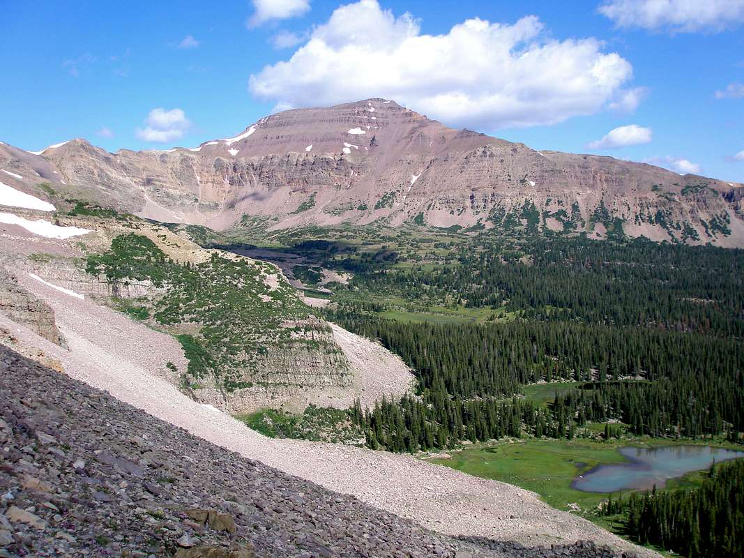
As an aside, as you can see from the map, we'll get a nice broadside view of Kings Peak and South Kings Peak, the highest and second highest mountains in the state on the way to Tungsten Pass.
Day 3
This day will be better if I make more miles on Day 2, but either way, I pass along Trail 0025 near the treeline on the south side of the main ridge of the Uintas for several miles heading towards the Lovenia group of big 13ers. At the end of this section is Red Knob Pass, but before I get to that, I'll take a turn off trail to head for Explorer Peak, wherein is nestled the deepest lake in the Uintas, Crater Lake, which shows as totally frozen in this image, sadly (you can see a stark line where they have less up to date images, with more snow on them in this screenshot of the map.) I'd like to arrive at Crater Lake with plenty of time to enjoy the ambiance before the sun starts getting low behind the Explorer Peak ridge, but I'll do what I have to. I won't need to be in a big hurry on Day 4, so I can count on sleeping in a bit after this day is over.
Day 4
Sadly, the maps are considerably worse this far west, since they still show tons of snow (which won't be on the ground much at all when I'm there in eight weeks) so my hand-drawn lines of travel are a bit more shaky, and it's hard to even recognize exactly what the features I'm looking at are.
When I pack up camp at Crater Lake, I'll go up and over Red Knob Pass. If the weather looks good, we might even hit up Red Knob itself as a summit opportunity (with that and the two Balds, I'm counting three summits on this trip, although none of the really iconic ones.) From there, it's a relatively short hike (about two miles) to our campground for the night at Dead Horse Lake. Because of the relative shortness of the day, like I said, I won't mind sleeping in, and I hope to have time to summit Red Knob. Plus, since we're a few days in by now, we might be starting to tire. It'll be nice to have a relaxed day without lots of ground to cover. Plus, by all accounts (and judging from the photos I've seen) the Dead Horse area is one of the most dramatically scenic and beautiful in the entire Uintas.
Day 5
For Day 5, I don't even pack up the tent; we just load up our waistpacks with some water, some food and do some exploring. I want to climb up to the summit of Dead Horse Pass and cross over it to go see Reconnaissance Lake in the upper NE Rock Creek Basin, have lunch there and then come back again. If there's still time and we still feel like it, we can walk around some more in the Dead Horse area, find Lake Ejod, maybe even look over the pass into Allsop (although I'm not counting on this), but mostly just taking it a bit easier and not even putting our packs on at all.
Day 6
Now we pack up and go back over Red Knob Pass, but we stay on the Red Knob Trail and go into the Lovenia group. I count seven pass summits on this hike, although two of them are done two ways--Smiths Fork Pass, Tungsten Pass, Porcupine Pass, Red Knob Pass (westbound), Dead Horse Pass (westbound), Dead Horse Pass (eastbound) and Red Knob Pass (eastbound). Between that and (hopefully) three summits, my son and I can definitely say that we got the mountain hiking experience; we didn't just keep to lower basin floor trails in the forest, by any means. Ideally, I'd also climb up to the summits (but not go over) Wilson Pass and maybe even Allsop Pass.
After passing between Lovenia and "Wasatch BM" I'll ditch the trail again and camp in the small cirque basin or bight that separates "Wasatch BM", "NW Wasatch" and Tokewanna Peaks. This shouldn't be a long day either, but if I've got a fair bit of off-trail exploring, I might not make great time anyway.
Day 7
Finally, on the last day, we don't do anything special other than get back on the trail and hike to the car. It'll be several miles, so it's not like we'll make it before mid-afternoon, I'd guess, but still. I hope to have time to pass through Sheep Canyon on the way back to Vernal without feeling rushed, and then have time to shower, change and go eat dinner at Cafe Rio in town, get a good night's sleep in a house again, and then we hit the road back for home after this.
And again; this is the proposed plan. There are a few shortcuts baked into the plan, especially on Day 2, and if for whatever reason I'm running behind schedule, I can also ditch day 5's plans and use that day to catch up if needed.
It's a bit tricky measuring trail distances on a map, because you can only approximate with your scale ruler and trying to make as many turns in your measurement as possible to accommodate the fact that trails aren't straight lines. But my estimates are as follows:
Enjoy! Hopefully this will be interesting, and hopefully it will more or less correspond with what I actually end up doing. The maps as shown have more snow than I expect to see on the ground when I'm there in more than eight weeks. This is a little unfortunate, because it makes seeing the route and the features that I'll pass through more difficult. But still; it's what we've got. Hopefully, when I've got actuals (i.e., after the fact) then I can redraw this and by then the satellite images will be up to date and mostly snow free.
Day 0
Show up on Mirror Lake Highway. The backpacking itself starts the next day, but I want to get me and my son acclimated to the altitude. We'll drive around, look at the scenery, park at the Bald Mountain Trailhead and hike up the trail the Bald Mountain summit.
 |
| Bald Mountain summit trail |
 |
| Campground for the first night |
After a (hopefully) early start, I've got probably a good hour or two of driving further east into the wilderness on Forest Road 0058 and then Forest Road 0063 to get to the East Fork Blacks Fork Trailhead, which is the start (and finish) of my big backpacking loop. Once we park and get started, the first day we'll take the Bald Mountain Trail (no relation to the other Bald Mountain from Day 0) and go up and over the shoulder of Bald Mountain. Although I probably won't technically hit the summit, I'm going to count it anyway, because it's a big, broad, flat plateau of a summit, and I'll be up and over it for a considerable distance. After a good two miles of Bald Mountain summit, in fact, we'll finally drop back into the basin and make for Lower Red Castle Lake, where we'll set up camp.
I'd like to think that we'll still have enough gas for some exploring up to Red Castle Lake and Upper Red Castle Lake before it gets dark, but we'll see. It's a good 9 mile hike, more or less, with over 2,500 feet of elevation gain, most of that near the beginning of the hike to get up and over the Bald Mountain ridge. We may be too tired, or it may be too late.
 |
| Route on the first day, up and over Bald Mountain to Lower Red Castle Lake. Dotted line is (hopefully) additional exploring after camp is set up at LRCL. |
Although I may punt and just go past Red Castle and Upper Red Castle Lakes over Wilson pass to get to the south side of the main ridge of the Uintas, I'd like to do a little bit more scenic and longer route on Day 2. The plan is to go back just a bit to the junction with the Smith's Fork trail and then go south on the east side of Red Castle, passing East Red Castle Lake and Smith's Fork Lake. Then I'd have to cross over Smith's Fork Pass and from there find the junction with the Highline Trail (actually called the Ashley Forest Trail on my map at this point, but either way it's trail 0025.) There's another high pass, Tungsten Pass, and then I enter the Garfield Basin, a high alpine tundra basin, with little to no trees. This isn't going to be prime camping territory, given the lack of shelter from wind or storms, but I know plenty of folks have camped at North Star Lake before, so in a pinch, I'd camp near there. Ideally, I'd press on even further, but this is going to be a long and hard day as it is, so I'm keeping my options open. Anywhere between North Star Lake and Squaw Lake after yet another high pass (Porcupine Pass) is where I'll stop, in the area marked with the dashed line. Although this day will be long, whatever I can accomplish on Day 2 means ground I don't have to cover on Day 3. It will probably be better to suck it up on Day 2 if it's really reasonable, and get over Porcupine Pass, if I can.
 |
| Day 2 showing a lot of variability in terms of where we stop. |
Day 3
This day will be better if I make more miles on Day 2, but either way, I pass along Trail 0025 near the treeline on the south side of the main ridge of the Uintas for several miles heading towards the Lovenia group of big 13ers. At the end of this section is Red Knob Pass, but before I get to that, I'll take a turn off trail to head for Explorer Peak, wherein is nestled the deepest lake in the Uintas, Crater Lake, which shows as totally frozen in this image, sadly (you can see a stark line where they have less up to date images, with more snow on them in this screenshot of the map.) I'd like to arrive at Crater Lake with plenty of time to enjoy the ambiance before the sun starts getting low behind the Explorer Peak ridge, but I'll do what I have to. I won't need to be in a big hurry on Day 4, so I can count on sleeping in a bit after this day is over.
 |
| To Crater Lake |
Sadly, the maps are considerably worse this far west, since they still show tons of snow (which won't be on the ground much at all when I'm there in eight weeks) so my hand-drawn lines of travel are a bit more shaky, and it's hard to even recognize exactly what the features I'm looking at are.
When I pack up camp at Crater Lake, I'll go up and over Red Knob Pass. If the weather looks good, we might even hit up Red Knob itself as a summit opportunity (with that and the two Balds, I'm counting three summits on this trip, although none of the really iconic ones.) From there, it's a relatively short hike (about two miles) to our campground for the night at Dead Horse Lake. Because of the relative shortness of the day, like I said, I won't mind sleeping in, and I hope to have time to summit Red Knob. Plus, since we're a few days in by now, we might be starting to tire. It'll be nice to have a relaxed day without lots of ground to cover. Plus, by all accounts (and judging from the photos I've seen) the Dead Horse area is one of the most dramatically scenic and beautiful in the entire Uintas.
 |
| Again; sorry about all of the snow. It's hard to even recognize Dead Horse Lake from this image. I think my line might go a few hundred yards out over the surface. |
For Day 5, I don't even pack up the tent; we just load up our waistpacks with some water, some food and do some exploring. I want to climb up to the summit of Dead Horse Pass and cross over it to go see Reconnaissance Lake in the upper NE Rock Creek Basin, have lunch there and then come back again. If there's still time and we still feel like it, we can walk around some more in the Dead Horse area, find Lake Ejod, maybe even look over the pass into Allsop (although I'm not counting on this), but mostly just taking it a bit easier and not even putting our packs on at all.
 |
| Same map as above, but with a packless route over Dead Horse Pass. This is an out and back; we'll follow the same route back again. |
Now we pack up and go back over Red Knob Pass, but we stay on the Red Knob Trail and go into the Lovenia group. I count seven pass summits on this hike, although two of them are done two ways--Smiths Fork Pass, Tungsten Pass, Porcupine Pass, Red Knob Pass (westbound), Dead Horse Pass (westbound), Dead Horse Pass (eastbound) and Red Knob Pass (eastbound). Between that and (hopefully) three summits, my son and I can definitely say that we got the mountain hiking experience; we didn't just keep to lower basin floor trails in the forest, by any means. Ideally, I'd also climb up to the summits (but not go over) Wilson Pass and maybe even Allsop Pass.
After passing between Lovenia and "Wasatch BM" I'll ditch the trail again and camp in the small cirque basin or bight that separates "Wasatch BM", "NW Wasatch" and Tokewanna Peaks. This shouldn't be a long day either, but if I've got a fair bit of off-trail exploring, I might not make great time anyway.
 |
| Back over Red Knob Pass, but up to the Tokewanna cirque basin. |
Finally, on the last day, we don't do anything special other than get back on the trail and hike to the car. It'll be several miles, so it's not like we'll make it before mid-afternoon, I'd guess, but still. I hope to have time to pass through Sheep Canyon on the way back to Vernal without feeling rushed, and then have time to shower, change and go eat dinner at Cafe Rio in town, get a good night's sleep in a house again, and then we hit the road back for home after this.
And again; this is the proposed plan. There are a few shortcuts baked into the plan, especially on Day 2, and if for whatever reason I'm running behind schedule, I can also ditch day 5's plans and use that day to catch up if needed.
 |
| Last day; the car is parked at the northeast endpoint of the red line. |
- Day 0: 2 miles hiked, no packs.
- Day 1: 9 miles backpacked, 3-4 miles hiked after setting up camp. That doesn't seem like a lot, but since I probably can't actually put boot to trail until 8-9 AM, and I have a lot of elevation to gain, it'll be a big day even with relatively low mileage.
- Day 2: Depending on where I stop, between 7½ and almost 13 miles. Yikes on the longer of those estimates!
- Day 3: 8 miles at the shortest, but if I have to take miles off of day 2, it could be up to 13 miles or even a bit more too. Ideally maybe I should find a place to split the difference; 7½ to 8 mile days sound a bit on the soft side (although with three passes, maybe not) and 13 sounds a bit on the long side. The total of both days is about 21 miles; can I get a more even split at about 11 miles/day and find a good camping spot in between? There do look to be some lakes on either side of Porcupine Pass that could make adequate camping spots with access to water to refill our bottles. We'll see. Either way, Days 2 and 3 are likely to be the hardest by far.
- Day 4: I only measure 5 to 5½ miles here. Granted, a substantial chunk of that is off trail, there's a pass to summit, and maybe even a peak, but this is the first easy day since Day 0.
- Day 5: Not really backpacking, but still walking 5 miles one-way to Reconnaissance Lake, and another 5 miles back.
- Day 6: I count about 7 miles, two of which are off trail.
- Day 7: 10 miles, two of which is off trail.
Grand total rough estimate of mileage? 68.5!
Monday, May 4, 2015
More changes
As you can see, my itinerary does not stay very solid. The latest over the weekend; my brother will not be able to join me after all, but my 13 year old son is for sure in (instead of maybe in, as he has been for months now.) Although I'm very disappointed not to have my brother along for the hike, because our schedules didn't completely align, I can now think of itineraries without the constraint of getting him back to the car on time, which potentially opens me up to consider a different approach than I've had on my mind for the last several months.
So, here's a few fundamentals:

So, here's a few fundamentals:
- The Red Castle area has been on my list since last year, when it got cut. I'd really like to do that.
- The Dead Horse Lake area has quickly risen to the top slot of desirable locations in the Uintas.
- I'll be there, at least part of the time, over the July 4th weekend, so I need to expect some crowds, especially near the end of my trip.
- I can't hit the ground running and expect it to go well. Not only am I going to have to drive at least a few hours from my "home base" in Vernal to the Trailheads for those two trails (East Fork Blacks Fork and West Fork Blacks Fork respectively) meaning I'll either have to start at a crazy early time of the morning with driving, or get a later start hiking than I'd like) but my first day at elevation probably doesn't want to be a major, hard hike with a lot of elevation gain.
These fundamentals create a dilemma of sorts where I'll have to accept a compromise of fundamentals. To whit:
- If I go to the Dead Horse area first, that means that I'll be doing Red Castle over the holiday, and will have to deal with crowds.
- If I do Red Castle first, I might minimize my exposure to crowds (and I'm making the possibly unwarranted assumption that Dead Horse won't also have crowds here) but I'll have to have an unreasonably difficult first day of backpacking to get up over Bald Mountain and to Lower Red Castle Lake at a decent time of evening. Major altitude sickness is sure to follow, making for a miserable day.
- If I cut Red Castle completely from my itinerary and focus on less crowded areas that I can reach from West Fork Blacks Fork, I can do that, but then Red Castle gets missed yet again.
Part of my problem is that sheer number of destinations I want to see. My plan was to base-camp at Dead Horse Lake and spend at least three days there; arriving in the evening on Monday, seeing Reconnaissance Lake over the pass in Rock Creek Basin the next day, seeing Crater Lake over Red Knob Pass on Wednesday, and hiking on Thursday (possibly) over the ridge/pass to Allsop Lake and exploring that area. Friday has me leaving the Dead Horse area and coming back to the car, where I'd drive it to East Fork Blacks Fork and spend the night near the trailhead. Saturday I'd hike over Bald Mountain Ridge to Lower Red Castle Lake, spending a no-doubt busy holiday weekend with however many folks make it to the area. Sunday, I'd go over Wilson Pass to escape the crowds, and then go back over Squaw Pass to spend the night in the southern Little East Fork basin. Monday I'm back at the car, hopefully early enough that I can drive to the other Bald Mountain on the Mirror Lake Highway and summit it before heading back to Vernal.
Does that seem like a really full agenda that has me in a potentially busy part of the range on one of the busiest days of the year? Yes, yes it does.
So I'm not sure exactly how, at this point, to remedy that. I'll probably just have to suck it up and deal with the crowds, or suck it up and have a hard first day getting to Red Castle. I'm also a little nervous about the Allsop Lake day. I'm also thinking of resurrecting my original idea of a bigger loop hike without base-camping at all--although in that case, I'm cautious of setting myself for really big, miserable days.
Anyway, with this new information about my brother's availability then I've got decisions to make that I didn't have a couple of days ago.
I'm actually fairly strongly inclined to reintroduce some form of my original loop hike plan, which now I can stretch out to cover the entirety (or nearly so) of my hiking time. Stretching it out like that means that I don't have to deal with the really killer big-mile, big elevation days that scared me away from the itinerary the first time, since I can slow down and take more time to cover the same distance. Here's a proposed altered itinerary of this plan:
I'm actually fairly strongly inclined to reintroduce some form of my original loop hike plan, which now I can stretch out to cover the entirety (or nearly so) of my hiking time. Stretching it out like that means that I don't have to deal with the really killer big-mile, big elevation days that scared me away from the itinerary the first time, since I can slow down and take more time to cover the same distance. Here's a proposed altered itinerary of this plan:
- Spend Monday getting to the area, summit Bald Mountain (the western one on Mirror Lake Highway) and spend the night in a campground nearby. In fact, I'm thinking it'd be nice to camp somewhere like Bear River Snowpark, which would put me part of the way on the road towards EFBF, at the same price.
- Early Tuesday, drive to EFBF Trailhead. Hike to Lower Red Castle Lake, and explore the Red Castle Basin in the evening--hopefully I have time to climb up Wilson Pass (without our packs) or at the very least climb to Upper Red Castle Lake.
- On Wednesday, go around the horn to Smith Fork's Pass via East Red Castle Lake and Smith's Fork Lake. Go over Smith's Fork Pass, around the next horn to go over Tungsten Pass, and stay the night somewhere in the Garfield Basin. If I'm doing good on time, go over Porcupine Pass too and set up camp near one of the lakes near there. Maybe I could even make it to the treeline south of Squaw Pass. The more ambitious route could be a hard day (three passes and lots of miles! but I don't have any need to push it unless I really feel like it. Whatever pushing I do do, however, improves Thursday. And then by Friday, I'm into more relaxed days again.
- As an aside, I can vary this somewhat. If I get to Lower Red Castle Lake late, rather than going around to the east side, I can skip that section and just hike out past Red Castle Lake and Upper Red Castle Lake, and take the Wilson Pass to to the Oweep Basin, rather than going around through Garfield. This is surely shorter and it's nice to have in my back pocket if we feel like it, but I'm wary of making too many cuts until I see how things are going.
- On Thursday, take the Highline Trail around Lambert Meadow and Mount Lovenia. Before crossing Red Knob Pass, head towards Crater Lake, where I'll set up for the night.
- On Friday, cross Red Knob Pass and set up at Dead Horse Lake. This will be my base-camp scenario here. If this is a shorter day, that's OK. In fact, by this point, it'll be highly desirable, I think. We'll be tired!
- On Saturday, explore the area. Climb up Dead Horse Pass, at least, and depending on the weather and how we're feeling, maybe go all the way to Reconnaissance Lake in the Rock Creek Basin. Head back to the same site for camp. In fact, I wouldn't actually decamp at all.
- On Sunday, decamp and head back across Red Knob Pass to the East Fork Blacks Fork Trail. I might hop off the trail and explore the meadows around Tokewanna and Wasatch Benchmark rather than sticking to the trail. Heck, there's even a small lake or two in this "bight" of the ridge where I could set up the tent.
 |
| There are also creeks/streams, at least on my map, going up into the meadowy bight shown there, right in the shadow of the cliff-face, where I could camp and have ready access to water. |
- On Monday, have a lazy morning getting up late, taking down camp, and making it back to the car. See a few sights on the way back, like Sheep Creek Canyon in the Flaming Gorge area, etc. Back in Vernal on Monday afternoon in time to shower, change, and go out to eat. Cafe Rio, here we come!
I actually think I'm liking that itinerary quite a bit. It's relatively relaxed, but it allows me to see a lot of stuff, although I do have to cut a few areas that I was really interested in seeing--Allsop Lake for sure, and maybe Reconnaissance Lake too, not to mention the Buck Pasture approach to Dead Horse. However, to make up for that, I can see the eastern bight of the Wasatch/Tokewanna ridge, because I'll be hiking right through there anyway, and I can nab the Smith's Fork Basin as a freebie on my way out of Red Castle; it's only a couple of miles out of the way, and it's worth it to take an hour or two to pass through the area when it's so close. Again, not that I wouldn't rather have my brother able to come, but now that he's not, I can look at routes that are completely uninterrupted through the entire time that I have available to hike.
Subscribe to:
Comments (Atom)