Day 1: (Monday). Big Sandy Trailhead up the Fremont Trail. I've put my Night 1 tent marker between Skull Lake and Pyramid Lake. Actually, the way I've drawn the route, I turn east to go off-trail up the East Fork Valley before getting to Pyramid Lake, but I honestly don't care which way it goes. The reason I picked that was to avoid gaining elevation that I'm simply going to lose again shortly. Camping anywhere between Skull Lake and Pyramid Lake, including the Mays Lake near the fork would all be fine (not named in some layer presets.)
 |
| Skull Lake at sunset |
 |
| Pronghorn Peak and Donna lake |
Day 3: (Wednesday). Especially assuming that I went and saw Pronghorn Peak on Tuesday afternoon or evening, then this is mostly just a day to keep moving. Pack up camp, backtrack through the East Fork Valley, and go over Hailey Pass to Baptiste Lake. This is only about 10 miles, but there's a fair bit of elevation gain and loss, so it could be a hard day, maybe. I'd love to get to Baptiste Lake early enough to spend the evening poking around the Baptiste cirque and basin a bit before nightfall, looking at the immense granite nearly 2,000 foot tall north face of Mount Hooker. If not, there'll be at least some time in the morning.
 |
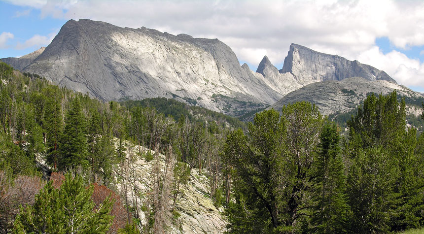
| Mount Hooker |
Day 4: (Thursday). This is a relatively short day, where I just have to leave the Baptiste Basin, ring the north shore of Grave Lake and set up camp somewhere in Ranger Park (presumably near Valentine Lake, but if I feel like it, I can set up anywhere in the area near a creek, stream or other lake. They're all close to each other.) Having a short and relatively flat day midway through the trip means I can take it easy and recover before I have to do a few more interesting days before finishing. It would also give me opportunity to explore a bit if I feel like doing that.
 |
| Valentine Lake |
 |
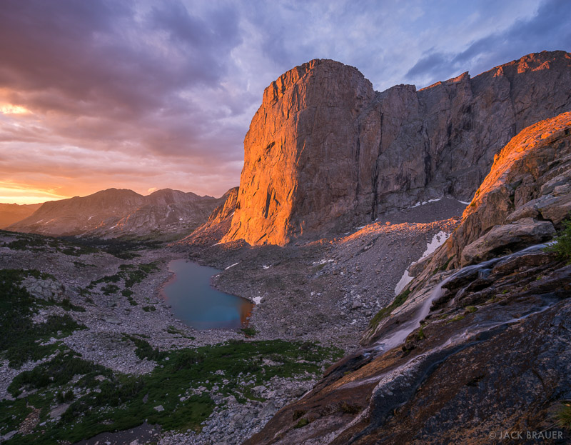
| Cirque of the Towers |
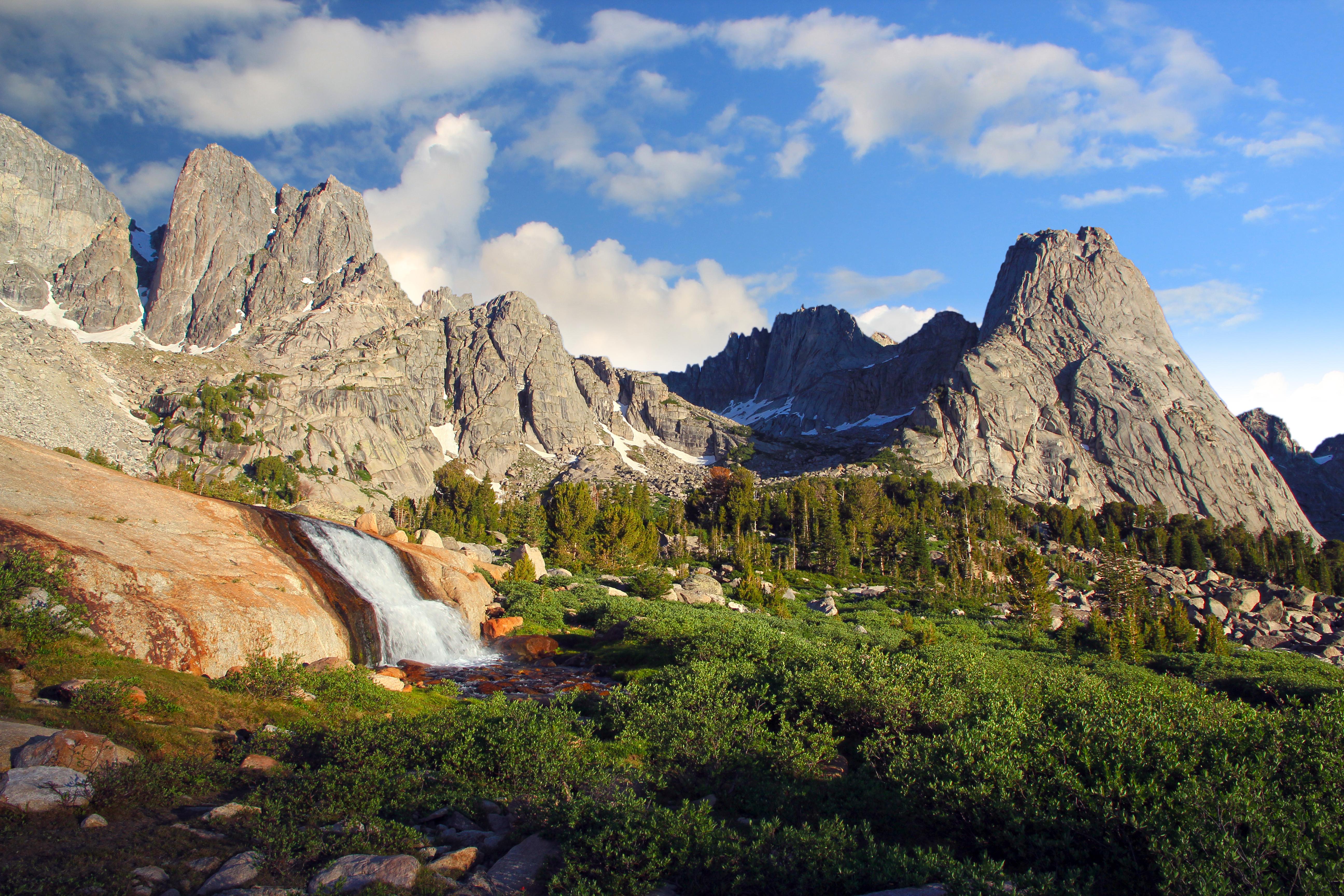
 |
| L to R: Haystack, the Steeple, East Temple. Temple is just to the right of this shot. |
What I like about this itinerary: It's no more stretched out that my other one, but by dropping a lot of the weird out and back spurs and exploration (which I will miss, no doubt) I'll end up keeping my miles down to a manageable 10 or less per day (except for the first day, but I'll be fresh then, and it's also pretty flat.) I'll still need to make sure that I continue the training regime that I've started already to be ready for it, because at altitude and with a fair bit of elevation gain and loss, 10 miles a day is quite a bit more than 10 miles here at what is only a couple hundred feet or so above sea level on a flat sidewalk or gravel trail. I think of 10 miles as no big deal, but on rough trails, or even cross country, ranging up and down from just over 9,000 feet to right at 12,000 feet on my shortcut pass, it's quite a bit harder. I tried to keep big elevation gain days down in mileage; Day 2 and Day 5 have the biggest elevation gains, but I'm coming and going over passes many of the days.
I still see most of what I really want to see, even though I had to drop a few minor side trips. I still see the East Fork Valley. I actually added the Bonneville Lakes and Donna Lake stuff, because I hadn't realized that I was so close, and I think it's a shame to miss it if I'm literally right there. I still see Mount Hooker and the Baptiste Basin, and I still see Ranger Park, the Lizard Head approach and of course, the Cirque of the Towers; the real headliner attraction in the area. I've also added the East Temple stuff, after realizing that I can do that fairly easily too (although it'll mean another night in a tent).
What I don't like about this itinerary: I don't really like traveling or hiking so much on Sundays. I'd prefer to take a break and go to church. Maybe I'll actually have time to stop by a ward in Wyoming or Nebraska sometime for at least Sacrament Meeting without it putting me too far behind schedule on the way to the Wind Rivers. However, given my distance and the time involved to get to the area, it's probably a necessity that I use that time so I don't have to use extra vacation days to do the trip.
I also think that this may be pretty close to the limit of how long I could possibly want to be out in one trip. No matter how interested I am in seeing the Temple area, by the time I've already spent 5 nights in a tent, I may be more interested in being done than in seeing one more area, no matter how scenic and spectacular. Well, if so, I have that option; I can come straight from Jackass Pass to the car and skip the Temple area altogether, cut my trip one day short and still feel good about having done a challenging 55+ mile hike in some of the most beautiful country that we've got in America.