Wednesday, July 8, 2015

Uintas 2015

Starting with a few pictures first, here's our "altitude acclimatization" day at the Bear River camp, Bald Mountain pass, and the Provo River falls.
Alex at the Bear River

Cliffs of Bald Mountain Pass

Our campsite at Bear River.  The pump gave us rusty water that we didn't like.  We ended up refilling water bottles in the river instead.

Alex on the river.  I was standing in it in my "river shoes."

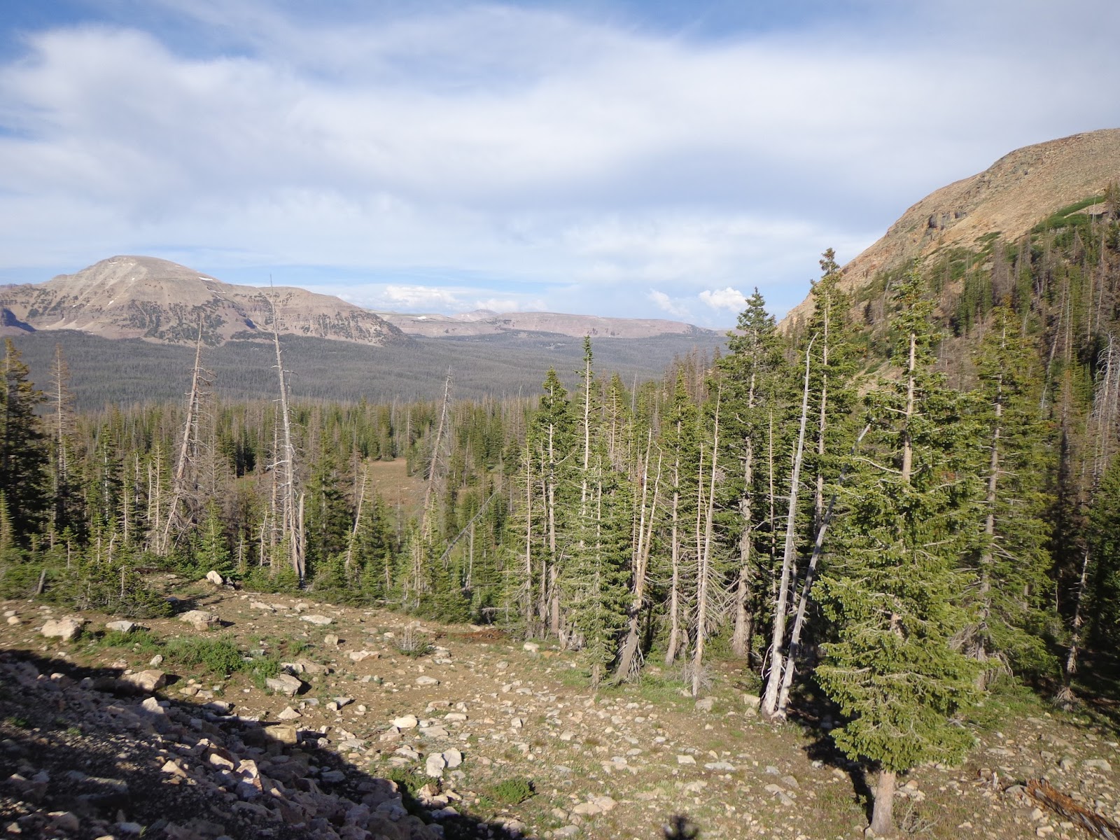
The view from Bald Mountain Pass, including the distant Wasatch range.

Pyramidal mountains of the western Uinta range.

Alex scampering around the cliffs of Bald Mountain pass right after a pounding hailstorm blew through.

The picture that made Mom nervous...

Nice view of the cliffs.  We weren't really that high, of course, and the bench/ledge system made it easy to navigate by scrambling without ever feeling anything "technical."

I sent Alex a bit out to help give a sense of scale.

Looking back out over the pass to the east.

We couldn't help doing a little scrambling.  It was fun.

Looking towards the west.  The clouds are just starting to clear again.

Lots of rocks.

My radioactive green shirt.  The mountain behind me is, I believe, Haystack.

Alex at the upper falls.

The view area was a little too touristy for our taste; we left it and went scrambling down to the middle and lower falls off trail on the other side of the river.

Provo river falls

Alex still climbing around near the falls.

Surveying his domain.  Middle falls?  Lower falls?  Can't remember anymore.

Alex near the lower falls.

Trying to get back out from the lower falls was actually easier said than done.

Looking out towards Agassiz; where I went last year.

Agassiz from the Mirror Lake Hwy.

Hayden from Mirror Lake Hwy.

More of the peaks near the highway.

Two-pronged Kletting peak; I camped and scrambled all over the far side of this mountain last year, but due to an error in route-finding where I went for the subpeak instead of the actual peak, I never actually made the summit.


Ostler and Spread Eagle from back near the Bear River ranger station.

A-1 peak from near the ranger station.

A more panoramic spread of the peaks from the ranger station.

Monday, June 22, 2015

Weather update

Well, it certainly looks like I nearly spooked myself over nothing.  I've looked at the weather, and hot and dry for the 10 day forecast in the area looks pretty solid.  In fact, too hot, if it sticks, although to be fair, my weather report was from every town around the perimeter of the Uintas I could find; I'll obviously be up higher than Kamas, or Evanston, or Mountain Home, etc.  But still; word is out that the Uintas are melting out fast, and since I still have a solid week before I'm there, I can hope to see very little snow fields other than in secluded hollows, and with any luck, maybe not even we won't see too much mud or bogs or mosquitoes.  Not that we won't be prepared for that anyway, but one can hope.

But after some last minute anxiety, I've decided to stick with my initial plan after all.  We'll see how it goes.  In the meantime, I've got a fair bit of tasks to complete prior to leaving, including (but not necessarily limited to):

  • spraying our hiking clothes with permethrin and letting them dry.
  • buying most of our hiking food.
  • repackaging our hiking food
  • packing our packs
  • packing what we'll need for the driving days
  • getting a haircut
  • charging up the camera battery
  • reviewing the driving route with my son so he can help as navigator
  • reviewing the hiking route with him too, for the same reason
  • review the Backpacking merit badge requirements so I can kill that bird with the same stone that I'm using to go on a backpacking trip that I want to go on anyway.

Thursday, June 11, 2015

I need a Plan B!

Well, I talked to the Rangers at the Evanston Ranger Station, and word on the street is that it's been pretty wet; the snow up above around 11,000 has not really melted much.  This is... not what I was hoping for.  Although my trip is still 2½ weeks away, if I don't have 2½ weeks of warm weather, I'm not going to be crossing any high passes without an ice ax and crampons (neither of which I have, and neither of which I want.)  So I'm probably going to need a Plan B that I can plug in as an alternate just in case I need to invoke it due to trail and snow and weather conditions.  I'll be crossing too many high passes and see too many frozen lakes otherwise, which isn't really what I had in mind.  Again; I'm pretty ticked off with how my schedule kind of forced this trip to be this early this year.  Oh, well.  It is what it is, and so Plan B--in case I need it--here's a first stab at it.

MONDAY: Still go to Bear River camp.  If Bald Mountain is all snowy, then I'll just hike around the area instead.  Heck, maybe I'll even spend the night inward a bit; go up to Ibantek Lake or something.  Either way, this isn't meant to be a tough day; it's more a show up and start getting acclimated day.  If there remains too much snow on Bald, then I'll have to pass up climbing it, though.  Not happy about that, but it is what it is, right?

TUESDAY: I can take Alex to Naturalist.  I didn't really see as much of it as I'd like, and he's never seen it at all, of course.  If I hike in on Tuesday and set up camp up near Faxon Lake--after coming in from wherever I set up camp on Monday night, that's probably a big enough jaunt for this day.  I don't know how much time I'll have to explore afterwards, but I don't want to overdo it.  I'll probably still be adjusting.

WEDNESDAY: Explore Naturalist Basin, especially up on the bench.  Explore the entire bench, in fact; from the southeastern edge beyond Shaler Lake all the way to the far edge beyond Blue Lake.  Maybe I can find a good way to get up on the ridge that separates Naturalist from Middle, based on snow conditions.  Spend another night in Naturalist.

THURSDAY: Hmm... options here.  The south side of the main ridge will probably have less snow than the north side, but the north side has more stuff that I want to see.  I'll have to have checked in with the rangers before doing this already, and see what kinds of availability there is with regards to passes.  I'd like to get over Rocky Sea pass into the Rock Creek basin and basically do Peter Potterfield's trip (the trip that I had in mind for last year, but which I cut short without doing all of it, sadly.)  But crossing the pass might be difficult.  So, let's make crossing Rocky Sea Pass a Plan C rather than a Plan B.  Rather, Plan B has me hiking back out to the car and driving to Christmas Meadows.  But I'm a little unsure of the timing.  I don't want to have to hike all the way back to the Highline Trailhead, drive to Christmas Meadows and then hike all the way to West Basin, Middle Basin or Amethyst Basin if that means way too much hoofing it in terms of mileage.  I might need to find a place to camp on the way.

FRIDAY: West and Middle Basins.

SATURDAY: More of Middle Basin.  Camp up near Ryder, or one of the smaller BR lakes nearby.

SUNDAY: Hike out and drive to West Fork Blacks Fork TH.  Hike up towards Deadhorse Lake.

MONDAY: Can't take too long, but explore the Dead Horse area and then head back to the car.

As you can see, this is a much less aggressive trip.  In fact, in some ways, I wonder if it's not a better idea for us even if we don't have snow issues specifically because of that.  Hmm..


Monday, June 1, 2015

Another possibility

I've been giving some thought to the idea that maybe I'm biting off more than I can (or want) to chew with my itinerary?  I'm not sure, but I'm not in peak backpacking physical condition myself, and bringing my son along, who's still just shy of 14, may mean that I want to make sure that I'm not overextending via planning too much.  There's also the possibility that the weather and snowpack won't be as melted as I hope it to be and expect it to be, in which case I'll also have to make modifications to the trip.  If I come to believe this, what are some of my options?  My Day 0 at Mirror Lake highway won't change for any of these plans.

  • Break up the Red Castle and the Dead Horse areas into two trips, with stops to the car and movement to another trailhead in between.  The most conservative plan might actually increase my mileage, so I won't spell that out, but this plan would look like:
    • Day 1 is still the same; go to Red Castle Lake.  Day 2 is to explore a bit and then head back to the car.  If I wanted, I could even spend two nights at the same campsite and do plenty of Red Castle exploring before heading back to the car.  Maybe a better plan would be to camp at Lower Red Castle, and then head over Wilson Pass and come back over Squaw Pass and get to the car via Little East Fork Basin.  I haven't ever heard that the Little East Fork Basin itself is anything special, although the south rim of it, where I'd join, is supposed to be nice.  There'd be a long, rather boring forest walk back to the car though.  If I camped the second night in the southern reaches of the Little East Fork, I could make a nice loop, basically this guy's route but I'd be doing what he recommends rather than what he actually did.
    • On the third day, back at the car, I drive to the WFBF trailhead, or as near as i can get to it, depending on whether or not I need to ford the river in my car, and start heading into Buck Pasture.  I don't think I'd even want to consider trying to get to Dead Horse Lake on night 3, so I'd camp somewhere en route and then continue on the next day.  This means that I'd be foregoing the stay in the arms of the Tokewanna/Wasatch cirque, and that I may not the do the Reconnaissance Lake jaunt either, depending on how much walking I will have done by this point.  The plan involves a night 3 somewhere in Buck Pasture, a night 4 and 5 and Dead Horse Lake, and a night 6 at Crater Lake.  I'm concerned about getting back to the car all the way from Crater Lake though, I admit.  Maybe I'd be better off moving the Crater Lake day up, and spending the final night in the wilderness somewhere closer to the Lovenia cluster so I can get back to the car at a decent time on Monday afternoon?  This also depends on how close to the WFBF trailhead I can actually end up parking, to some degree.
  • Although I'm a little loath to do it, I could cancel the Red Castle area.  Again.  And just really explore the Dead Horse Lake area, including Reconnaissance Lake, Crater Lake, and I can surely find a way to work Allsop Lake and maybe even Priord Lake into it if I do this.
  • Of course, I can always lop off the Reconnaissance area loop and just shorten my "big loop" but otherwise keep more or less to it.  Camp at North Star Lake on night 2, for instance, making Day 2 a two-pass rather than 3-pass day, and spend night 3 at Lambert Lake instead of Crater Lake.  This makes Day 4 really short, since I really don't want to miss Crater Lake, but that may be just fine.  Day 5 would still be at Dead Horse (this effectively becomes a 2-pass day as well, since there's no way I'm going to Dead Horse Lake and not summiting the pass to look over into Rock Creek Basin; although being able to do that without a pack would be nice, of course.)  This is the least disruptive of my plans, since it only chops off an optional no-pack leg, while still maintaining the entirety of my backpacking loop.  The advantage to this is that I can keep it flexible and not even have to decide until either late on day 2, or even day 3--in theory, I can make day 3 longer and get back on track even if day 2 ends up getting shortened.

Friday, May 22, 2015

Avoiding interstates

An interesting aside: I'm driving from SE Michigan, where I live, to Vernal, UT where my sister-in-law lives, and which will serve as a "base-camp" for my foray in the High Uintas Wilderness.  I really dislike driving on Interstates.  They're busy, crowded, and boring.  Whenever I can, if it's reasonable, I like to duck off of interstates and drive on some other type of road.  While small two-lane roads may seem slower, they often have so much less traffic that you don't necessarily make worse time.  While getting to central Nebraska pretty much requires driving non-stop on interstates--I-80 mostly, but also some I-94 between Detroit and Chicago--it's not hard to avoid much of the interstate travel other than that, and get much more relaxed and even scenic drives for what will be my second day (of two) of driving to Vernal and my first day (of two) of driving back home can be spent mostly on other roads, which I'll enjoy quite a bit.  Here's the plan for North Platte, NE to Vernal first, followed by the plan from Vernal to Omaha.

Head west for just a little bit until you get to Ogallala.  I actually hoped to stay in Ogallala for the first night, but I couldn't get a place.  But this is a short hop, done very early in the morning (I'll start before sunrise) and then I get off and take little US-26 up towards Gering and Scottsbluff.  This is a nice drive, with a scenic overlook on Lake McConaughy, up past Ancient Ruins Bluffs, a stop at Chimney Rock, and then an exploration of Scott's Bluff National Monument.

After spending no more than an hour to an hour and a half there, head out of town south on 71, turn west on 88, and then turn southwest again on 85 which takes us into Cheyenne.  Not only is this a scenic and interesting little aside, but it's a very nice, smooth drive; when I did it last year, I hardly saw any other traffic on the road at all.  It was relaxed and the happiest part of my entire driving experience (which isn't ever going to be as fun as my hiking experience, but still.)

I've got to bear another couple of hours of I-80 after getting to Cheyenne, but at Rock Springs I can head south on 191, which is a great scenic drive through Flaming Gorge National Recreation Area and the eastern end of the Uintas, before coming back down again into Vernal.

On the way back home, rather than going back north to Rock Springs, I'm going to head directly east on US-40.  Take this quite a ways; just past Steamboat Springs, actually, then turn northeastish on 14.  This will give me the extremely scenic North Park-Cache le Poudre route into Fort Colllins.  Staying on 14 after exiting the mountains will take me directly east where I'll eventually combine with I-76 which angles upwards to join I-80 not far from Ogallala, actually.  This way, I get to avoid interstates for most of two (out of four) driving days, and in fact even specifically get to visit some scenic byways while I'm at it.

I'm quite excited, actually, that I've managed to come across this.  It was a pure accident of noodling over a road atlas and noticing that I'm not really going very far out of my way to do it this way.  And no doubt I'll really enjoy the driving experience that much more.

I'll still have the same Ogallala-Detroit interstate experience--twice, both west and eastbound--but that's tolerable.  I'll survive.

Wednesday, May 20, 2015

Gear

Should have a shipment from Amazon, hopefully arriving today, which will complete the penultimate gathering of gear for my hike.  The only thing(s) left to pick up following the arrival of this package is another permethrin bottle, a fuel canister, and my food.  We're about done.  How did we do?

  • I got a free pack.  A friend of mine was having a garage sale, and had stumbled across one that he called me and asked me if I wanted before he sold it.  It's not the perfect pack, and probably not what I'd have bought if I were to buy one.  It's a big bigger and heavier both than I'd prefer.  But it'll do, and it's free.  And I'll mostly only use it when I have someone with me who's using the other pack, which I like better.  I can't even remember what brand it is so I can look it up and try and figure out its capacity, but it looks like probably some local off-brand pack, and it looks bigger than my 50L.  I'm guessing it's probably about a 65L or so.
  • I have another sleeping bag.  It's bigger and heavier than the one I already was using, but then again, I wasn't very warm last year either.  Since my wife is very worried about my very skinny 13 year old son being cold at night, I'm willing to put up with an extra pound or two to carry a sleeping bag that makes her more comfortable... even if it doesn't do much for me.  And may or may not do much for him; don't know yet.  He actually doesn't appear to sleep very cold, honestly, in spite of his very wiry frame.  He does get cold when swimming easily, though, so who knows.
  • I wasn't going to do anything with any kind of stove or cooking and go with cold, no-prep food.  However, since I'm hoping to piggy-back off of this trip to get my son the Backpacking and Hiking merit badges, I had to look up the requirements for both, and... you guess it, you have to actually do the following, so I bought one: 
    • Explain the advantages and disadvantages of different types of backpacking stoves using at least three different types of fuel.  
    • Demonstrate that you know how to operate a backpacking stove safely and to handle liquid fuel safely.  
    • Prepare at least three meals using a stove and fuel you can carry in a backpack.
  • Once everything is fully packed and ready to go, I'll post a picture of my gear, like I did last year.  I'll probably weigh in again too, although I expect bad news in this regard; I'm bringing a few more things and bringing a few heavier things.  The only saving grace is that I'll be able to share some of the load; we only have one tent between us, for example, and only one stove.

Wednesday, May 13, 2015

2016 and 2017

I haven't done my big 2015 hike yet (counting down the weeks, though, and soon days!) but I'm giving some thought to what to do for the next year or two.  This isn't urgent, but it's fun, so what the heck.  I've already posted a big list of hikes that are high on my "want" list, but this is a very different kind of post; what I'm a most likely to actually do next?

First off; let me just say that although there are lots of destinations left in the Uintas that I want to see, I want to break from them and do something else.  But just for the sake of completion and because I like lists, here's the highpoints of what I still want to do:

  • Middle, West and Amethyst basins as a single trip, about a week, about 4 days.
  • See Naturalist and Rock Creek basins a bit more.  3 days.
  • Allsop and Priord Lakes basins. 2-3 days.
  • Henry's Fork Basin and Kings Peak summit.  2-3 days.
  • "Western Uintas" including Notch Mountain, Ibantek Lake, etc. 2 days, probably.
That's probably two more trips, where I can combine bullet points there and see it all in another two summers, assuming my backpacking trips remain somewhere between a week and two weeks, like they most likely will.  But again; I'm ready to try something new.

Constraints:  I've already got some plans for next year that I have to work around.  I'll have to take the week around July 4th off again, and will probably use that for a family trip with my folks and my son.  My older son comes back from Ecuador and then he and my daughter will be off for college.  Although my wife is much more likely to take them and leave me to ferry the younger boys to and from their various destinations here locally, we are planning a big family trip--probably another week--in late July or early August.  This means that I've only got two weeks of vacation left to play with, and that presumes nothing else comes up that would warrant me spending time off, and it also means that much of July and August is already booked, and I can't have two consecutive vacations, I'm afraid.  That leaves me looking at either shoulder seasons, or somewhere where the hiking season is not quite the same as your typical Rocky Mountain destination.

Actually, a mid-September trip with golden aspens sounds really fun.  So that's a possibility.  Otherwise, I'm looking at trying my hand at a desert trip, which I haven't done for a while.

Here's the round-up of potential trips that I'd be more or less likely to do for 2016.
  • Try out Cortez, Colorado.  I can see Mesa Verde for a couple of days, and then head into the La Plata Mountains, which are nearby.  This would probably best be done in September.
  • The Four Pass Loop in the Maroon Bells-Snowmass Wilderness outside Aspen, CO.  This would again have to be a September trip.
  • I could also potentially see a bunch of Wasatch Mountain destinations in Utah in September.  I could even crash in between destinations with family or friends, possibly--this is the least wildernessy experience of them all, but it has its attractions.  I could get to Lake Blanche, I could summit Timpanogos, I could summit maybe Mount Olympus, or at least explore it, I could summit Mount Nebo, etc.  This could also be combined with any number of other Utah day-hiking or shorter trip destinations; I could explore the La Sals or the Henrys while I'm at it too.  This has a lot of attractions, but would likely be the most expensive option, because it would involve more driving around and more nights in hotels, most likely.
  • If I get a really early start on things, I could do Big Bend National Park in February.  I doubt I'll be ready to roll again that early, but you never know.
  • I could also go in March and/or April to various desert or semi-desert locations -- the Grand Canyon, Coyote Gulch + some Arches or Canyonlands stuff or Palo Duro Canyon + Caprock Canyon.  This could also be done in the fall; October or even November.
  • An October traverse of the Roans Highland section of the AT, plus some exploration of Shining Rock Wilderness would be a major change of pace from the Rockies, and would be fun. And the timing isn't bad for me in 2016.
Of that list, the September mountain trips are the most appealing to me, but again, timing might be tricky.  Second are the March/April or October/November desert trips.

In 2017, I may have other constraints that I don't know of yet, but with two kids going to school in Eastern Idaho (most likely) that opens up the opportunity to take advantage of a visit to them to also hit up the Shoals Loop in the Gros Ventre Mountains and the Teton Crest Trail, another very highly desired destination of mine.