Starting with a few pictures first, here's our "altitude acclimatization" day at the Bear River camp, Bald Mountain pass, and the Provo River falls.
 |
| Alex at the Bear River |
 |
| Cliffs of Bald Mountain Pass |
 |
| Our campsite at Bear River. The pump gave us rusty water that we didn't like. We ended up refilling water bottles in the river instead. |
 |
| Alex on the river. I was standing in it in my "river shoes." |
 |
| The view from Bald Mountain Pass, including the distant Wasatch range. |
 |
| Pyramidal mountains of the western Uinta range. |
 |
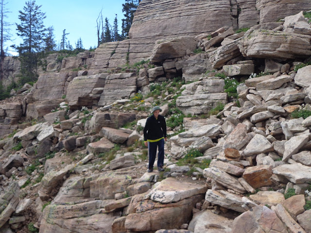
| Alex scampering around the cliffs of Bald Mountain pass right after a pounding hailstorm blew through. |
 |
| The picture that made Mom nervous... |
 |
| Nice view of the cliffs. We weren't really that high, of course, and the bench/ledge system made it easy to navigate by scrambling without ever feeling anything "technical." |
 |
| I sent Alex a bit out to help give a sense of scale. |
 |
| Looking back out over the pass to the east. |
 |
| We couldn't help doing a little scrambling. It was fun. |
 |
| Looking towards the west. The clouds are just starting to clear again. |
 |
| Lots of rocks. |
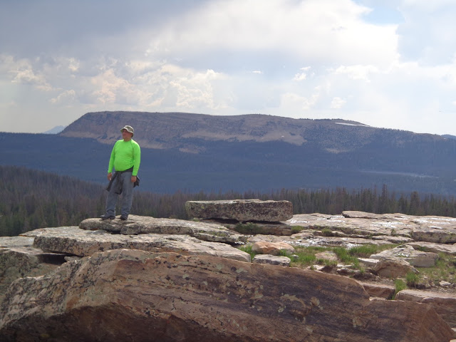 |
| My radioactive green shirt. The mountain behind me is, I believe, Haystack. |
 |
| Alex at the upper falls. |
 |
| The view area was a little too touristy for our taste; we left it and went scrambling down to the middle and lower falls off trail on the other side of the river. |
 |
| Provo river falls |
 |
| Alex still climbing around near the falls. |
 |
| Surveying his domain. Middle falls? Lower falls? Can't remember anymore. |
 |
| Alex near the lower falls. |
 |
| Trying to get back out from the lower falls was actually easier said than done. |
 |
| Looking out towards Agassiz; where I went last year. |
 |
| Agassiz from the Mirror Lake Hwy. |
 |
| Hayden from Mirror Lake Hwy. |
 |
| More of the peaks near the highway. |
 |
| Two-pronged Kletting peak; I camped and scrambled all over the far side of this mountain last year, but due to an error in route-finding where I went for the subpeak instead of the actual peak, I never actually made the summit. |
 |
| Ostler and Spread Eagle from back near the Bear River ranger station. |
 |
| A-1 peak from near the ranger station. |
 |
| A more panoramic spread of the peaks from the ranger station. |


No comments:
Post a Comment