
Monday, October 24, 2016
Archiving hiking plans for the GYE
EDIT: Added to pages, rather than as a post. See Pages list to the top right.

Thursday, October 20, 2016
Shoal Falls Loop
My wife has actually suggested that I fly to my next backpacking trip, rent a car, and go that way rather than drive out. I'm surprised, because this will no doubt be more expensive (and as the CFO of the house, the budget is kinda "her thing"). This is still early, and I don't know if it's going to be serious or not. I'm on the fence. I don't want to spend more money, even if it is "her job" to find it in the budget, it's mostly "my job" to make the money, and I'd kinda like to spend it somewhere else, I think. Plus, I don't care about putting more miles on my car; it's over five years old and just rolled over 100,000 miles a week or two ago anyway. But... if I do that, it buys me a couple more days. If I could fly out Friday afternoon or evening, leaving work a little early, but not so early that I need to spend more vacation time, I could potentially hike the Saturday and Sunday that I would have been driving there, and still get back early enough to save a vacation day on the tail end. Four days of driving is a big deal, and while I like a good road trip as much as the next guy, I admit that I wouldn't mind collapsing four days of travel just to get to my backpacking area of choice down to maybe a day of hanging out in airports, on planes, getting a rental car, and driving just a few hours from airports to trailheads.
What would I do with an extra two or three days or so? Well—the easy answer is that I can do the same trip and just spend less time away from home doing it, which is always an answer. But, maybe I can slip in another small trip to somewhere else that I'd really like to see in the area too. One option is the Shoal Falls Loop; a route that's more or less detailed in Backpacker Magazine and elsewhere, but at the same time, for anyone who knows anything about the area, it is pretty obvious. It hits the highest scenic high points of the Gros Ventre Wilderness in two simple days; or three if you take your time, or otherwise take a side-trip or two. While I admit that there are other places in the Gros Ventre that I'd like to see other that what this loop shows (Brewster Lake, the Six Lakes area, etc.) this is often considered a major scenic high point of the entire Jackson Hole area. And, of course, the big advantage is that it's short. And another advantage is that hardly anyone goes there. Compared to the Tetons or the Winds, it's empty. (The Winds can be empty when you get away from Cirque of the Towers and Titcomb Basin too, of course...)
I've whipped up a Caltopo for this trip that includes the entire loop as a single route, including a couple miles or so of an exploration of nearby Deer Ridge that offers tremendous views of the area and comes highly recommended. I've marked three potential campsites, but Campsite #2 at Shoal Lake is the one I'm most likely to want to do. Unless Deer Ridge ends up taking more time than I think.
I've also added a spur hike to Brewster Lake; a potential day hike if I set up camp at Shoal Lake and stay there two nights. I doubt I'd do this, but it's worth noting as an option anyway. If I do, it makes it much more likely that I'd be "done" with the Gros Ventres for some time; why go back when I've seen all of the must-dos and I have so many other places still to explore in the West?
Here's a few images I've found online here and there.
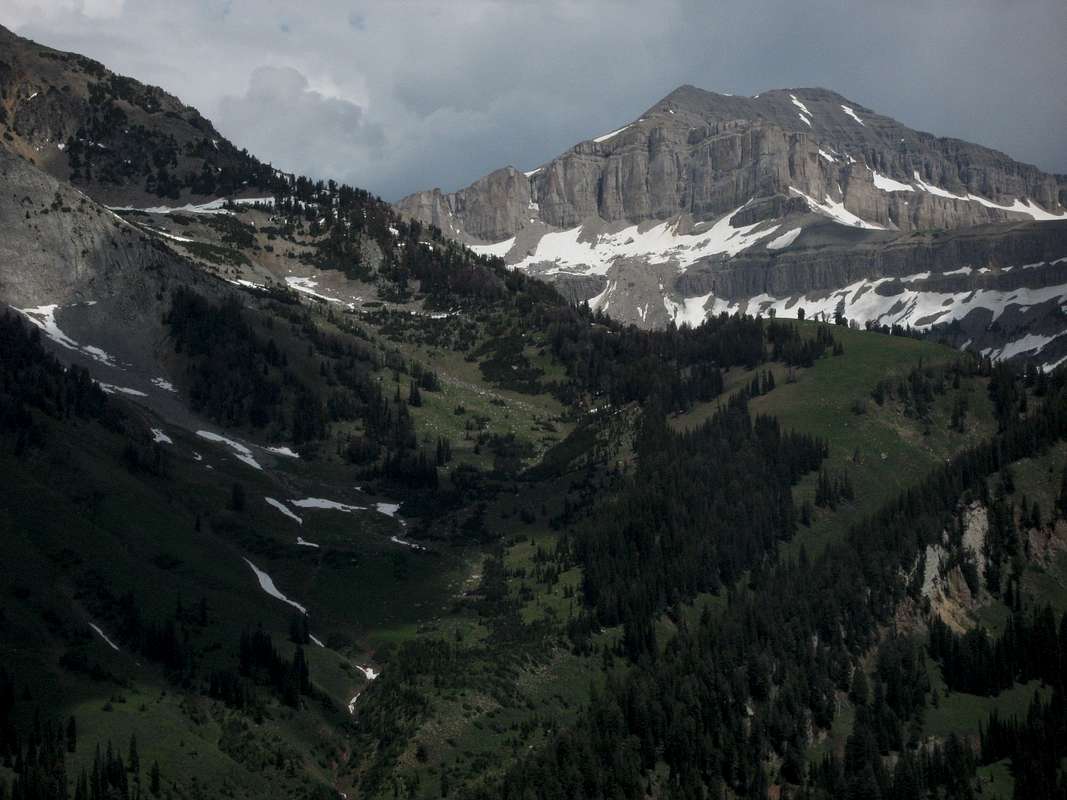 |
| Doubletop Peak from Deer Ridge. Doubletop is the range high point. |
 |
| Palmer Peak from Deer Ridge |
 |
| High pond on the route |
 |
| Shoal Lake |
 |
| Black Peak with summer wild flowers |
Wednesday, October 19, 2016
Further exploration of potential Wind River routes
I continue to tinker with ideas, although I was quite happy with the "lollipop" loop that I'd constructed to go from Big Sandy to the Cirque of the Towers, and then loop around and see more of the Wind River range. In a perfectly ideal world, I'd have the entire month of August to explore the GYE, and I'd do this hike in it's most expansive iteration, plus my Beartooth loops, a big loop of the Gros Ventre range, and a hike of the Teton Crest Trail... with a couple nights in the Teton Lodge to do laundry, rest up in a real bed and eat some nice food in between excursions into the backcountry. In the real world, I'll do—most likely—this Winds hike, with some version of the Beartooth hike as first alternate. Tetons is right out if I don't even get around to applying for a permit, which this year I almost certainly won't.
So, I've made some minor tweaks to the itinerary, in an attempt to see more of the places I've mapped out with as little backtracking as possible. My schedule is somewhat constrained, but not so much that it'll be a major show-stopper. To take as little time off work as possible, I have to make Saturday and Sunday be driving days. I leave Saturday in the morning, get to somewhere in the middle of Nebraska that night, and then get to the Big Sandy campground by evening on Sunday. Given past experience in driving to Vernal, UT, which is not exactly the same direction after leaving Nebraska, but which is the same mileage and time, give or take a small amount, I should not have any trouble arriving before dark, setting up camp, and getting a good night's sleep at the Big Sandy campground before starting the hike.
On the other hand, if my wife really does encourage me to fly out, then I have even more flexibility on which days of the week are what.
Day 1: Skip the Cirque of the Towers the first time around. If I go during my enforced "shutdown" week, it'll be July 3rd, and the place will be crazy busy (although I'd like to do something else that week and go in mid-August when conditions are almost certain to be better in the mountains.) Take the alternate Fremont Trail instead on the west side of Laturio Mountain. The ideal, although given that it's the first day I may not be up for quite this much hiking—would be to get all the way to Pyramid Lake on Day 1. This cuts an entire day off my itinerary from the former plan (although I'll use it later with day trips and whatnot) and means that I don't brave the famous Cirque of the Towers until near the end of the trip, when hopefully the holiday crowds will have cleared out. Miles so far: 12.3. If I don't make it all the way to Pyramid Lake for whatever reason, I can stop at Marm's Lake or Skull Lake instead, or even Dad's Lake in a real pinch. I don't know why I wouldn't unless altitude acclimatization tires me out a lot faster than I think it will (which did happen to some degree the last two times I was in the Uintas) but honestly, if that's going to be a major issue at this point, it'll probably cause more problems for the entire itinerary than simply getting to Pyramid Lake the first day, and I'll have to do more in the way of cuts. On the other hand, if I can do more miles and have a good, strong, first day, then I can take the little black extension off-trail to go see the magnificent Donna Lake with it's bizarrely shaped Pronghorn Peak. If I get myself in decent shape before going, and start nice and early first thing in the morning, that's not completely out of the question.
Day 2: Get up in the morning and explore the adjacent East Fork Valley (of which I've seen stunningly beautiful pictures on Google Maps.) I've heard some others call this Desolation Valley as well, but it's the East Fork Creek watershed, so I suspect that's the proper name for it. This is 3 miles one way (as mapped on Caltopo; in reality, it's just wandering around until I've seen as much as I want.) Pack up camp and take the relatively short hop over Hailey Pass and set up again at Baptiste Lake. Admire the massive rock wall of Mount Hooker, maybe even watch some climbers given that it might be July 4th and people will be off work. Shake my fist at the arbitrary line that divides the lake and the valley overall between the Shoshone National Forest and the Wind River Indian Reservation. (Probably) refrain from trespassing onto the reservation. Miles so far: 24.03 although half of day 2's miles are without a pack, so they'll be a ton easier.
Day 3: Backtrack back to the Bears Ears Trail, go around the north end of Grave Lake to Ranger Park, and go off-trail beyond Valentine Lake to South Fork Lake to set up camp, a relatively shorter day of 9 miles (although I'm given to understand that beyond Valentine Lake the going might be a little tough, but worth the trouble.) Miles so far: 32.8

Day 4: Before breaking camp, go explore the valley to the west, and climb up to the summit of Washakie Pass on the Continental Divide. Take pictures, enjoy the views both directions of the east and west sides of the divide and the nearby peaks, including Mount Washakie itself, for which the pass is named. Head back to camp and take it down, and then take a short jaunt around Cathedral Peak towards the Cathedral Lakes, to set up the next camp. The day hiking portion is just short of 5 miles one way, so it'll take a fair bit of time (until early afternoon, no doubt) to do, but the rest of the trip to my proposed Cathedral Lakes campsite is only a little under five more miles. This makes for a long day of walking, but I've only got my pack for a third of the distance. If it seems like too much, the Washakie basin exploration can be cut somewhat shorter and lop a few miles off the total. That's just for scenic appreciation anyway. Miles so far: 47.89.
Day 5: Bushwhack back around the Cathedral Peak massif and get back on the trail. Head south on the Lizard Head Trail around Lizard Head Peak and into the Cirque of the Towers from the northeastern entrance. This may be a long day, so if I stop early at Lizard Head Meadows, that'd be fine. Otherwise, go all the way to Lonesome Lake. This is a 12½ mile day, with nearly three of that bushwhacking what may be rough country, so that's fine. Miles so far: 60.42.
Alternate Day 5: If the bushwhack is rather rough, and I have at least one guy who said that it was, this is an on-trail option that gets me to the same entrance to the Cirque without the bushwhack. It's a little longer, but it's all on trail. It depends on whether I'd rather add 3-4 miles, or brave the bushwhacking. In an ideal world, I'd go check out the High Meadows hanging valley while I'm at it, but I almost certainly won't have time for that. It's a real shame; it looks intriguing on the topo.
Day 6: Completely unscripted exploration of the Cirque of the Towers without moving camp. I have no idea how many miles I'll walk this day, because it's just an exploration of whatever I feel like looking at. Walk around Lonesome Lake. Look for waterfalls and streams. Maybe walk all the way east to Papoose Lake, or Cirque Lake and the other lakes up near Texas Pass, etc. Maybe even get to the top of Texas Pass to look on the other side. By this point, my purpose is to kill time, relax a bit, enjoy one of the most scenic places in the United States and rest up for a long hike out (which, luckily, is mostly downhill after going over Jackass Pass, though) the next day. Because the exploration is unscripted, I have no idea how many miles I'll actually cover but I whipped up an estimate in Caltopo that I'll probably log about 10-12 miles. Miles so far: ~71.
Day 7: Hike back to the car. About 9 miles over Jackass Pass, and then all downhill and supposedly easy walking. Should be back to the car early enough to get into Pinedale or Lander or somesuch, clean up in a hotel and eat at a restaurant for the night, before heading back home. Total hiked miles: ~80.
This completes an entire week of vacation, including the bookend weekend days, but I still need an additional 2 days to get back home, so that'll have to happen Monday and Tuesday, and have me back at work by Wednesday; because July 4th is a holiday, that means I only need to take 6 vacation days to make this trip happen.
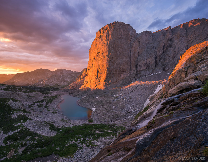
Hotlinking images from Jack Brauer photography. I'm not actually grabbing or saving the images, just linking to them at their original site. See them in their original context here: http://www.mountainphotographer.com/in-the-winds/
So, I've made some minor tweaks to the itinerary, in an attempt to see more of the places I've mapped out with as little backtracking as possible. My schedule is somewhat constrained, but not so much that it'll be a major show-stopper. To take as little time off work as possible, I have to make Saturday and Sunday be driving days. I leave Saturday in the morning, get to somewhere in the middle of Nebraska that night, and then get to the Big Sandy campground by evening on Sunday. Given past experience in driving to Vernal, UT, which is not exactly the same direction after leaving Nebraska, but which is the same mileage and time, give or take a small amount, I should not have any trouble arriving before dark, setting up camp, and getting a good night's sleep at the Big Sandy campground before starting the hike.
On the other hand, if my wife really does encourage me to fly out, then I have even more flexibility on which days of the week are what.
Day 1: Skip the Cirque of the Towers the first time around. If I go during my enforced "shutdown" week, it'll be July 3rd, and the place will be crazy busy (although I'd like to do something else that week and go in mid-August when conditions are almost certain to be better in the mountains.) Take the alternate Fremont Trail instead on the west side of Laturio Mountain. The ideal, although given that it's the first day I may not be up for quite this much hiking—would be to get all the way to Pyramid Lake on Day 1. This cuts an entire day off my itinerary from the former plan (although I'll use it later with day trips and whatnot) and means that I don't brave the famous Cirque of the Towers until near the end of the trip, when hopefully the holiday crowds will have cleared out. Miles so far: 12.3. If I don't make it all the way to Pyramid Lake for whatever reason, I can stop at Marm's Lake or Skull Lake instead, or even Dad's Lake in a real pinch. I don't know why I wouldn't unless altitude acclimatization tires me out a lot faster than I think it will (which did happen to some degree the last two times I was in the Uintas) but honestly, if that's going to be a major issue at this point, it'll probably cause more problems for the entire itinerary than simply getting to Pyramid Lake the first day, and I'll have to do more in the way of cuts. On the other hand, if I can do more miles and have a good, strong, first day, then I can take the little black extension off-trail to go see the magnificent Donna Lake with it's bizarrely shaped Pronghorn Peak. If I get myself in decent shape before going, and start nice and early first thing in the morning, that's not completely out of the question.
Day 2: Get up in the morning and explore the adjacent East Fork Valley (of which I've seen stunningly beautiful pictures on Google Maps.) I've heard some others call this Desolation Valley as well, but it's the East Fork Creek watershed, so I suspect that's the proper name for it. This is 3 miles one way (as mapped on Caltopo; in reality, it's just wandering around until I've seen as much as I want.) Pack up camp and take the relatively short hop over Hailey Pass and set up again at Baptiste Lake. Admire the massive rock wall of Mount Hooker, maybe even watch some climbers given that it might be July 4th and people will be off work. Shake my fist at the arbitrary line that divides the lake and the valley overall between the Shoshone National Forest and the Wind River Indian Reservation. (Probably) refrain from trespassing onto the reservation. Miles so far: 24.03 although half of day 2's miles are without a pack, so they'll be a ton easier.
Day 3: Backtrack back to the Bears Ears Trail, go around the north end of Grave Lake to Ranger Park, and go off-trail beyond Valentine Lake to South Fork Lake to set up camp, a relatively shorter day of 9 miles (although I'm given to understand that beyond Valentine Lake the going might be a little tough, but worth the trouble.) Miles so far: 32.8
Day 4: Before breaking camp, go explore the valley to the west, and climb up to the summit of Washakie Pass on the Continental Divide. Take pictures, enjoy the views both directions of the east and west sides of the divide and the nearby peaks, including Mount Washakie itself, for which the pass is named. Head back to camp and take it down, and then take a short jaunt around Cathedral Peak towards the Cathedral Lakes, to set up the next camp. The day hiking portion is just short of 5 miles one way, so it'll take a fair bit of time (until early afternoon, no doubt) to do, but the rest of the trip to my proposed Cathedral Lakes campsite is only a little under five more miles. This makes for a long day of walking, but I've only got my pack for a third of the distance. If it seems like too much, the Washakie basin exploration can be cut somewhat shorter and lop a few miles off the total. That's just for scenic appreciation anyway. Miles so far: 47.89.
Day 5: Bushwhack back around the Cathedral Peak massif and get back on the trail. Head south on the Lizard Head Trail around Lizard Head Peak and into the Cirque of the Towers from the northeastern entrance. This may be a long day, so if I stop early at Lizard Head Meadows, that'd be fine. Otherwise, go all the way to Lonesome Lake. This is a 12½ mile day, with nearly three of that bushwhacking what may be rough country, so that's fine. Miles so far: 60.42.
Alternate Day 5: If the bushwhack is rather rough, and I have at least one guy who said that it was, this is an on-trail option that gets me to the same entrance to the Cirque without the bushwhack. It's a little longer, but it's all on trail. It depends on whether I'd rather add 3-4 miles, or brave the bushwhacking. In an ideal world, I'd go check out the High Meadows hanging valley while I'm at it, but I almost certainly won't have time for that. It's a real shame; it looks intriguing on the topo.
Day 6: Completely unscripted exploration of the Cirque of the Towers without moving camp. I have no idea how many miles I'll walk this day, because it's just an exploration of whatever I feel like looking at. Walk around Lonesome Lake. Look for waterfalls and streams. Maybe walk all the way east to Papoose Lake, or Cirque Lake and the other lakes up near Texas Pass, etc. Maybe even get to the top of Texas Pass to look on the other side. By this point, my purpose is to kill time, relax a bit, enjoy one of the most scenic places in the United States and rest up for a long hike out (which, luckily, is mostly downhill after going over Jackass Pass, though) the next day. Because the exploration is unscripted, I have no idea how many miles I'll actually cover but I whipped up an estimate in Caltopo that I'll probably log about 10-12 miles. Miles so far: ~71.
Day 7: Hike back to the car. About 9 miles over Jackass Pass, and then all downhill and supposedly easy walking. Should be back to the car early enough to get into Pinedale or Lander or somesuch, clean up in a hotel and eat at a restaurant for the night, before heading back home. Total hiked miles: ~80.
This completes an entire week of vacation, including the bookend weekend days, but I still need an additional 2 days to get back home, so that'll have to happen Monday and Tuesday, and have me back at work by Wednesday; because July 4th is a holiday, that means I only need to take 6 vacation days to make this trip happen.
Hotlinking images from Jack Brauer photography. I'm not actually grabbing or saving the images, just linking to them at their original site. See them in their original context here: http://www.mountainphotographer.com/in-the-winds/
Tuesday, October 18, 2016
Possible Wind River excursion
I've been kicking around an exploration of the Beartooth mountains for the summer of 2017, but some of my other routes are still in play. I'm also extremely interested in the Wind Rivers; as the other GYE range that is made of a gigantic eroded pale, Sierra Nevada-like granite batholith, the two have similar features to recommend them. The Wind Rivers are, if anything, perhaps a bit less likely to put you face to face with a grizzly (not that it's likely in either range, but the spread of grizz's in the Winds is still light, and mostly focused on the north of the range) and a bit more craggy and serrated in general. I could happily do either of these routes this summer, and enjoy them probably equally. In spite of my momentum towards the Beartooths as I've investigated them the last few weeks, I'm almost leaning more towards the Winds already at this point. Here's how this route would look. The camp sites are provisional, and may end up being moved; the two spurs in particular can be cut off if needed to shorten the drip by about a day.
Most good Wind River hikes start at one of three trailheads; Green River Lakes, Big Sandy or Elkhart. This one makes it's debut in the middle of those; the Big Sandy trailhead, which looks something like this: http://brettsimison.photoshelter.com/image/I00004sF5MvXB1yo

Going to the Wind Rivers, if you've never been there before, absolutely cannot miss seeing at least one of the two banner locations to visit: Cirque of the Towers or Titcomb Basin. The former is to the south, and is the goal of the first day of backpacking on the route I've mapped up here. My goal would be to arrive at the trailhead by nightfall after driving from out east for two days, and car camping the first night, giving me a great full day to do the first leg of the backpacking trip. Over the course of just shy of nine miles, the route for this first day gains a gross almost 2,000 feet of elevation—a relatively modest gain, but big enough, especially for your first real day in the high country, that you'll want to be in at least halfway decent shape to do it. The steepest portions of the trail are entering the mountains proper after Big Sandy Lake, and then going over the pass that takes you into the Cirque. After this hike, you'll spend the night in the famous Cirque; hopefully without too much in the way of crowds. We'll see.
The next day, assuming that I'm too anxious to keep moving to spend another day exploring the cirque, has me going over Texas Pass to Pyramid Lake. Although not as famous for its grandeur as the cirque, pictures of the area are still stunningly beautiful... and it has another advantage; it's not a climber's Mecca like the cirque is. And after going over the pass, the rest of the day is relatively flat, which is also nice.
After spending the night at Pyramid Lake, I go over Hailey Pass and head towards Baptiste Lake, where you can see the north face of Mt. Hooker. How can you miss that? It makes for a short Day 3, but with a big pass to climb, and being that it's the third day, I'd like to take it easy and have a little time to explore the Baptiste Basin a bit. The next day, I backtrack back to the main trail and go by incredibly scenic Grave Lake before continuing on past Valentine Lake, the last little bit off trail to the South Fork Lakes. The next day, the penultimate, has me summiting Washakie Pass before closing the loop portion of the lollipop and spending the night at Shadow Lake, just shy of Texas Pass again. And the final day ends up being one of the longest in terms of miles (12) but much of it is downhill—although I do have to enter the Cirque again, and then cross another pass to get out of it. If I decide to take it just a bit easier on the home-stretch, I could further explore the cirque, and head east a bit towards Lizard Head Meadows.
I have to be careful not to get too ambitious, however. I've discovered about myself that in the comfort of my office planning these trips on my PC, that I often get really excited about rambling all over the countryside and seeing all kinds of things... only to discover that when my boots actually hit the ground that I have an effective limit of 4-5 nights before I'm kind of tired of eating trail food and sleeping on the ground. So my trip is already on the upper limits of what I tend to like doing. I've kept the days to 10-12 miles of hiking (or less) as much as possible, in an attempt to keep myself from getting too worn out, but I'm also seeing what I can do to get into better shape between now and the time I go, so maybe that won't be as much of an issue as it was in the Uintas (especially the elevation gain.)
I've also added an alternate short-cut loop that takes the Bears Ears Trail to the Lizard Head Trail and comes back to the Cirque of the Towers from the northeast. The intent is that this would be taken at Valentine Lake rather than heading west southwest across Washakie Pass. There are, of course, vaorus other methods of combining the legs of the loops into various potential short-cutted options. No matter what you choose, unless you spend more time than I am likely to be willing to spend, plus some not insignificant back-tracking, you have to miss a part of the Winds that I'd really love to see.
Sigh. Isn't that always the case? I've also, just for the heckuvit, added a nearly 3 mile (one way) day hike exploration spur up the Bonneville Basin. Given the very short day planned for Day 3 (which starts at the same place) this may not necessarily be an unreasonable side trip, depending on what kind of time I'm making in general on this trip.
Tuesday, October 4, 2016
Well, crap...
http://phx.corporate-ir.net/phoenix.zhtml?c=177739&p=irol-newsArticle&ID=2208410
Cabela's to be bought by Bass Pro Shops. Bass Pro Shops isn't a chump group, but they're no Cabela's. I don't know if they're buying Cabela's for the market share, or for the brands. I hope it's the latter, in which case, I can expect to see stuff continue as is (or at least similar to what it is) for some time.
I wear Cabela's jeans, Cabela's cargo pants, Cabela's socks, Cabela's jackets, Cabela's shoes for work, and Cabela's boots for hiking. If in the future when I need to replace what I have, I can't get Cabela's, I'm probably going to have to go with some snooty, smug, self-righteous (and most especially) over-priced alternative. Rail Riders for pants? Patagonia? The North Face? Am I going to have to buy them at REI? Blegh.
Not happy today.
Tuesday, September 27, 2016
Beartooths Part Deux
Well, I got that caltopo made quicker than I thought. Here's the skinny:
Part I: The "stick" of the lollipop for the Bear's Tooth hike is the easternmost red section. At 5.07 miles and nearly 1,500 feet of elevation gain, this might be the better part of a day, depending on how early I can get to the trailhead.
Part II: The purple loop is the exploration of Black Canyon Lake and the country all around Beartooth Mountain itself, including Spirit Mountain and Sky Pilot Mountain, numerous lakes, a lot of climbing (especially over that pass at Beartooth Mountain) and essentially no trail at all to speak of for most of the route. At 13.78 miles, and with nearly 5,000 of elevation gain, this is either a very long, hard day, or better yet, I'll stop somewhere partly through it at one of those lakes.
All in all, I see this lollipop taking 2½-3 days. The total mileage is Part I x 2 + Part II, or 23.92 miles. Not a bad little loop.
Part III: Assuming that I'm starting this fairly late, after doing the loop above, this is the "stick" of the second lollipop. It's 9.51 miles long, and gains over 3,000 feet of elevation gain itself, so it's not a picnic, exactly. I would tend to see it as the better part of a day's hike by itself; if I can't start 'til late, I need to camp somewhere inside the trail; maybe at either Elk or Rainbow Lake. If it's really late, I can always camp right there near the trailhead at Rosebud Lake somewhere.
Part IV: At 18.73 miles, this is the real meat of the whole trip. Continue on the "Beaten Path" trail to Fossil Lake at which point you break cross country to get to the Aero Lakes, go through the valley between Mount Villard and Cairn Mountain, have a good, up-close look at Granite Peak (the highest in Montana!) before heading back down to Big Park Lake and rejoining "the stick."
Part V: This little spur is completely optional, but goes up the hanging valley to the wonderfully scenic Martin lake, Glissade Lake, etc. The climb up to the hanging valley is supposed to be pretty brutal, but once you're there, it's not too bad. At only 3.11 miles, this is just either a day trip, or a nice, secluded camp site if I start it in the afternoon.
In total, this second lollipop is 43.97 miles (37.75 if I forego the optional hanging valley spur) which is still a good 4½-5 days. Both hikes together are, at a minimum, 6½ days, more likely 7½ or 8. That's a long time in the wilderness (I tend to find that after 4-5 days, I sometimes have had enough and am ready to come back) but after missing 2016, and assuming that I've been successful in getting in better shape before starting this year, it'll be doable. Plus, that means that I won't need to worry too much about coming back this way anytime soon, and I can see something else in 2018's summer.
The Beartooths
It looks like the Greater Yellowstone Ecosystem is on my radar again. Now I've got two contacts that aren't too far away, and one in particular that looks promising as a "staging area"—so rather than taking my summer 2017 trip in the Uintas again, which I've blogged about here probably ad nauseum, I'm thinking of a GYE hike. I'm really spoiled for choice in the GYE, but I've kind of focused on four areas as "highest priority" for the area that would trump all other potential options; at least until their done:
From the attached/linked map, you can see that the purple route can rather easily be converted into a lollipop by simply ignoring the second half where you go over Sundance Pass, up West Fork Rock Creek and up onto Rosebud Plateau to get to Rosebud Trailhead, and heading back to the Lake Fork Trailhead from Keyser Brown Lake. It's a bit of a bummer, but it's really Black Canyon lake, the actual Bears' Tooth, and then while I'm at it, since I'm so close, Sky Pilot Mountain that I want to see on that hike. The second half was more about linking the two routes than because anything on the second half was really a "must see."
- The Teton Crest Trail
- The Wind Rivers, including Titcomb and Indian basins, and Cirque of the Towers.
- An exploration of the Gros Ventre; the least ambitious option is only a night or two in a tent; the most ambitious is a good week and a half
- The Beartooths
I'm thinking of applying for Teton Crest Trail permits in my window and if I get it, then doing that (a probably 3-5 night outing, so I could do a minimalist Gros Ventre hike maybe as part of that trip) but if I don't—and I think that's the most likely, then I need to have a Plan B (which in many ways is actually the Plan A.) And for this, I find myself leaning towards the Beartooths.
I long ago came up with a caltopo map that shows a bunch of stuff in the area, and with the exception of marking the Sphinx and Helmet Trailheads, it's all right there in the Beartooths. However, I don't think these routes would work for me without a bit of modification. For the most part, they're point to point hikes (Lake Fork Trailhead to Rosebud Trailhead and Rosebud Trailhead to Cooke City/Colter Pass—which is the so-called "Beaten Path" route.) In addition to the point to point hikes, I've added a few options, but all of them require some kind of car shuttling. While it's not impossible that I could have access to easy car shuttling, I'd much rather be able to do all this independently on my own, which requires making loops out of these hikes. I'll need to spend some work and time on figuring out what the "greatest hits" of the Beartooths are, in that case.
From the attached/linked map, you can see that the purple route can rather easily be converted into a lollipop by simply ignoring the second half where you go over Sundance Pass, up West Fork Rock Creek and up onto Rosebud Plateau to get to Rosebud Trailhead, and heading back to the Lake Fork Trailhead from Keyser Brown Lake. It's a bit of a bummer, but it's really Black Canyon lake, the actual Bears' Tooth, and then while I'm at it, since I'm so close, Sky Pilot Mountain that I want to see on that hike. The second half was more about linking the two routes than because anything on the second half was really a "must see."
The "Beaten Path" (the Red Route) can be converted into a lollipop easily as well; if I follow it as far as Fossil Lake, which is almost all of the dramatic portion of the scenery, I can then hop on the light blue route (all of which is actually off trail, although I'm given to understand that use trails make up some of the route) I can rejoin the "stick" of my lollipop near Big Park Lake. I could even do the green option at this point if I'm not exhausted from all of this hiking and all of these days in the mountains at this point, although I've been told that the pass between Snowbank Mountain and Point 11,848 (that connects Bergschrund and Summit Lakes) is not a fun one; I might do either of those hanging valleys as spurs and not try to link them; assuming I do either of them at all.)
Later when I have more time, I might whip up a caltopo of those two proposed routes and see how many miles it really is. But for now, it's reasonably easy to see what I'm talking about based on the map above.
Subscribe to:
Posts (Atom)