Wednesday, February 10, 2016

Cabela's XPG Outkross hybrid jacket

As part of my birthday in January, I got a bunch of gift cards to Cabela's, and I picked up a bunch of clothing.  One of the items I picked up was the Deep Sea Cabela's XPG Outkross hybrid jacket, pictured here.  I hardly needed it; I've got a lot of jackets, but it was on sale for $65—normally $130, and I liked it, and I had the gift cards that I had to spend on something anyway, so... I picked it up.

Hybrid jackets are all the rage for active outdoorsy outerwear these days.  Hybrid can mean many things; in this case, what I got was a high-tech fleece jacket in side panels, sleeves, and along the bottom hem, with puffer jacket construction for most of the main torso, collar, and top half of the sleeves.  It's got fairly light 60-gram Primaloft Silver insulation in the puffer section; a relatively light weight for the loft, but one that comes with a bunch of nifty technical features, offering high warmth per weight ratio, and the ability to maintain loft even while wet.  The jacket also has a water repellent chemical finish.  Although I haven't taken it out in prolonged or hard precipitation, I certainly noticed that water beaded on the surface in light rain, and did not penetrate.  So it purports to do a lot of things all at once; but again, that's the appeal of a hybrid jacket.  It does not purport to be a really warm jacket, for wearing while sitting in a tree stand in freezing weather for hours, or anything like that, but for the active—backpackers, backcountry skiers, etc.—well, that's what it was specifically designed for.

A little bit of context.  Cabela's is, of course, well known as an outfitter for hunters and fishermen, mostly.  Backpackers and other non-sportsman outdoorsy types have typically turned to other brands like REI, Marmot, Patagonia, etc.  The North Face and Columbia and a few other brands also qualify, I suppose, but since they have become such a trendy brand for non-outdoorsy folks, it's hard for me to take them seriously—which is a shame, since they make good stuff.  If pricey.  Other more indy companies, like Rail Riders, Outdoor Research, Arc'teryx, and others also are go-to in reviews sections of backpacking blogs, magazines and whatnot.  In part because of this exact same wilderness chic that has propelled The North Face, Columbia, L.L. Bean, Eddie Bauer, and many others into big sales, and in part because Cabela's thought that they could probably sell to their existing customer base that already does more than simply fish and hunt while outside, they created the XPG—Extreme Performance Gear—brand, who's purpose is to compete head-to-head with the list above.  This is mostly, although not exclusively, a story of apparel.  Non-clothing gear includes a couple of backpacking tents, a sleeping pad, and some flashlights.  I'd already picked up some of their hiking boots, and quite enjoyed them last year while hiking in the High Uintas Wilderness of remote northern Utah.  But it's their technical active wear and outerwear that really bulks up the XPG brand.  The Outkross Hybrid jacket fits here.

The first thing I noticed when I picked the jacket out of the box—it's a lot greener than it looks in the picture online (which, as you'll notice, doesn't really appear to be green at all.  I'm OK with this, as various shades of olive and piney green are my favorite colors, but Deep Sea as a description isn't terribly descriptive and the picture online looks black, so that was surprising.  And for someone else who doesn't have green as his favorite color, potentially quite disappointing.

The next thing I noticed: the fit is extremely athletic; most likely smaller than you are expecting.  I was on the fence about XL vs. 2XL, and I went for the 2XL opting to use this more as an outer layer that should be a bit baggier, but there's no way I could have ever worn an XL.  2XL fits me about like what I expected an XL to fit.  Again; because I was on the fence, that wasn't a problem for me, but again, it wasn't what I was expecting either.  But the fit is more than just general bulkiness; there are thumb-loops on the sleeves, for instance, but if I try to put my thumb through the thumb-loops, then the sleeves fit a little too tightly.  Either I have long gorilla arms, extra broad shoulders, or again—the fit is just a little bit too small for most, and you need to order a size up.

I was surprised by how light and thin the jacket is, and yet, I've found it's surprisingly warm.  If it's going to be cold, it needs to be part of a layering system; it's not sufficient by itself, but I've been out in temperatures in low 30s for some time with a warm base layer underneath it and been perfectly fine.  If it's significantly below freezing, or if I'm going to be outside for a longer time, I'd put a lighter fleece jacket on underneath this and over a warm base layer, and expect to be just fine—in fact, I've done that for a while already.

I haven't tried to pack the thing up yet to see how small I can compress it, but given its general lightness, I have no doubt that it packs up pretty small.  I also haven't tried to put my rain jacket over it for really prolonged downpours, but for light rain and for wind, it seems to do a decent job.

A curious fact.  Previous Cabela's XPG products I've bought (like my boots) said Cabela's XPG as their brand.  This one simply says XPG; you only see Cabela's on the inside when it's off.  I was in the store recently trying on some shoes for work, and I got into a conversation with a guy working there, where I mentioned that.  He said that people claim not to want to be a "walking billboard."  He thought this was kind of funny, as these same people were openly wearing their North Face or Columbia jackets.  The branding of XPG, which minimizes Cabela's, is supposedly to avoid that.  But let's be honest.  These guys don't care about being a walking billboard; they simply don't want to be one for Cabela's.  Not that they don't love Cabela's.  But why then?  Because Cabela's is a hunting store, associated with guns, hunting, rednecks and the political Right.  And people don't want to be a walking billboard for that because we live in what has basically become a crowd-sourced police state.  It's pathetic.  And yet; I can't completely fault them.  It's easy to just say, "man up and don't be a coward," but if you're not substantially anti-fragile in your career and in your social life, the consequences of falling victim to one of those viral two-day hate fests that liberal "social justice warriors" oh-so-bravely engage in from afar with the backing of their mob of rabbits.  Too many of our people are afraid, or at least unwilling, to confront that, so they just don't wear their Cabela's brands in public if they can help it.  I tend to do the opposite; I'd wear nothing but Cabela's brand clothing if I could get away with it.  But my shoes, my socks, even my jeans being Cabela's brand doesn't really matter if they are discrete about their branding.

But, sadly, that gets to my final point.  Literally just a day or two after I bought this jacket, I was with my wife at Meijer, a Midwest big box that is like a slightly more upscale version of Wal-Mart, and we were looking at their winter wear clearance to get a new jacket for my sons.  I saw a New Balance hybrid jacket that looked very similar in design and styling to this XPG jacket I just bought.  And even though I bought this jacket at nearly half-off clearance pricing, the New Balance jacket was a fraction of that price: only about $25, if I remember correctly.  Now, perhaps you can argue that the Primaloft Silver filling is better than the filling in the New Balance (of which I'm doubtful that you could tell a difference in the field) the cost differential would make it worth it.  I bought one for my son, and I was really tempted to get one for me, even though the only one in my size was not the color I preferred.  My wife talked me out of it, pointing out that I just got this Cabela's jacket, and I already have more jackets than I need anyway.  But it made a great point: as much as I like Cabela's; you can usually get the same performance at a better price.  Looking for deals or sales at Target, Meijer, Kohls, etc. gets you the same stuff at an order of magnitude less money, and it's usually not chump brands either: C9 at Target is by Champions, New Balance is a serious brand, and they've got Ascics, Avia, Columbia, etc. stretching your dollar farther.

Monday, January 25, 2016

Western Uintas exploration

I like planning trips almost as much as I like taking them.

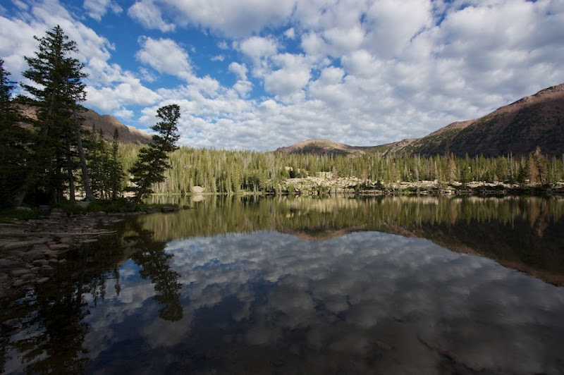
Well, not really... taking them is certainly better, but planning them is fun, and certainly easier, so I plan a lot of trips that I may or may not end up ever taking.  The following is a plan for me and (at least one of) my boys, or at least its designed that way.  It explores some of the area west of the Mirror Lake Highway in the Uintas, and then goes back to Naturalist Basin (which I visited a year and a half ago) allowing me to see the area again, and do a better job than I did last time of exploring the area.

It's not a complicated or a long trip—in fact, it only has four nights out.  By mid-, or at worst late afternoon on Day 5, I'd be pulling into a staging area somewhere in the SLC area.  This isn't really a long hike in terms of miles either; and in fact, it is broken up into a number of even shorter legs, after which I move the car to another TH.

Here's how the trip should play out:

  • On the first day, get up fairly early and get to Bald Mountain Pass as quickly as I can.  Hike up to the summit of Bald Mountain, enjoy the views, and be back at the car before lunch.  This is the light blue trail, and the total mileage is only 2.58 miles—1.29 one way, but repeated all the way back down.
  • The second leg is in green.  This one has me move the car to the Crystal Lake TH, and taking the Notch Mountain loop (see link for some examples of the hike), including going down from The Notch a bit to explore Ibantik Lake.  This is only 6.62 miles, with only a tiny bit of it (The Notch to Ibantik Lake) repeated; the rest is a true loop.  I only plan on doing 2 miles the first day—after tackling Bald Mountain, we may well appreciate a lazier afternoon, but if it's early enough, I can make camp at Ibantik Lake itself rather than past Clyde Lake and the Three Divide Lakes.  I'll have to play it by ear and see what time of the afternoon it is when I arrive at those lakes.  If it's any later than 5, I'll absolutely stop before tackling the Notch.  It's it's before 4, I'll absolutely continue on to Ibantik (unless the weather looks bad.)  If it's in between, I'll just figure it out based on how we feel.  After camping out near Notch Mountain—either on the southern or northern flanks, depending, we'll head back and be at the car by lunch-time the second day.
  • The third leg is in purple, and is also relatively modest (just under 6 miles as measured, but since some of it requires uncertain route-finding, might as well round up that last few hundred feet or so.)  Here's a great resource; some local guy did it with his Boy Scout group, so it's definitely a tried and true route (the former route is also really quite well established.)  It requires moving the car again to the Pass Lake TH.  As I have it marked, I imagine camping at Cuberant Lake, but again, if I'm there early enough and the weather looks good, I could go ahead and summit Marsell that afternoon and then come down on the eastern side and camp at Kamas Lake instead.  Again; the guy I'm linking to did that, and it only took him about 2½ hours, but he was trucking it to catch up to the Scouts who did that same distance over the course of an entire day instead.  I'll be in between those two extremes; if I get to the TH by early afternoon, as I imagine, I can—again—play it by ear depending on how I feel.  If I end up going up Marsell in the morning, I'll get very different pictures than the ones in the link; he obviously took his in later afternoon, and my shadows would be all reversed.
  • The final leg (in red) is the longest, at 14.5 miles, and is meant to also have two nights out.  After coming back to the car at Pass Lake, I'll drive a couple miles back to the Highline TH and start walking.  I've stayed in the past at Scudder Lake, and it's a pretty decent place to stop.  It might be early enough that I'm unwilling to stop there, however, in which case I'd have to press on into Naturalist Basin.  And if I end up walking that far, I might end up cutting the trip down by one night out.  In any case, assuming that I stay at Scudder Lake after coming off of Lofty and that area, I'd spend the next day getting to Naturalist, bypassing Jordan Lake and instead going up on the bench.  There are some good spots that I scouted last time not far from Faxon Lake where I'd probably set up camp.  This is meant to be somewhat leisurely; I should get from Scudder to Faxon by mid-afternoon, I think.  I can spend much of the evening exploring the eastern side of the bench in Naturalist Basin.  The next morning, I pick up camp and go explore the western side, including LeConte and Blue Lake; coming down from the bench via the Morat Lakes, making this part of the trip more like a lollipop than a regular out and back.  I don't know how long for sure I'd spend exploring the Blue Lake area (I might even drop my pack and go up on the ridge to look into neighboring Middle Basin) but by sometime mid afternoon, I want to be sure that I'm on my way back to the car, which will take a couple hours minimum.  And once I get there, another couple of hours, I think, to drive back to my staging point in the SLC area to take showers, change into clean clothes, and eat a high calorie restaurant dinner somewhere, hopefully with big juicy burgers and fries.
Anyway, here's the caltopo of this entire trip:


Total distance hiked (not counting any exploring that I'd do once set up) is only 29.5 miles.

Potential summits on this trip include: Bald Mountain, Mount Marsell, Spread Eagle Peak and Mount Agassiz.

UPDATE: Added a slight extra little bump.  If I decide to stay one more night, instead of continuing past Scudder Lake on the way out, I turn off on the Packard Lake spur and spend one more night there.  I'd get out of the mountains earlyish the next morning, instead of late that night.  But the overlook over the Duchesne River valley from the cliffs near Packard Lake looks amazing in some pictures... and as a destination, it was completely off my radar until just recently. Another alternative for this, depending on time and weather, is that I'd go to Packard Lake for night 3 instead of staying at Scudder.  Doing that means I can maintain my original schedule, although I have to add a couple of miles of walking to accomplish it.

Actually, the more I think about it, the more I prefer that alternative.

Friday, January 22, 2016

Stillwater Exploration trip


A lengthy yet relaxing itinerary for a part of the more westerly portion of the High Uintas.  The idea here is this; each number represents a day in this 7-day trip:
  1. Park early in the morning at Christmas Meadows.  Hike Leg 1: 8.8 miles to unnamed lake high up in West Basin
  2. Explore West Basin.  Don't move the tent, don't wear the backpack.  If weather and conditions are good, consider making an attempt on Kletting or A-1 summits.
  3. Hike Leg 2: 7.5 miles from West Basin to Middle Basin, setting up camp near Ryder or McPheters Lakes (or one of the unnamed small satellites).
  4. Explore Middle Basin. Climb up on either the ridge between Hayden and Agassiz, or the ridge between Agassiz and Spread Eagle.  Don't move tent or put on pack.
  5. Hike Leg 3: 9.9 miles from Middle Basin camp to the shores of Amethyst Lake.
  6. Explore Amethyst Basin, including finding Ostler and Toomset Lakes.
  7. Come back to the car: 6.1 mile Leg 4.  Go home.
I won't have the Vernal Connection any more by next summer (I'm a little unsure of the timing, but for sure by then it will be gone) but that's mostly OK because it's going to evolve into being an SLC connection.  Or technically, somewhere in the north of the valley, like Bountiful or Layton or Ogden or something like that.  Not that that's not just as good as Vernal, I suppose.  I'll miss the pleasant drive along 191, though, and won't have any more excuses to go visit the Sheep Creek Geological Loop on the way to the trailhead.

Best done during the week.  Middle and Amethyst Basins are well-enough known by the local backpacking cognoscenti that they are not without their crowds on weekends, but there are lots of tales of folks who've gone during the week and had the entire area to themselves.

Here's a handful of images thanks to Google Image Search to complete the picture:

West Basin and Kermsuh Lake


Middle Basin


Amethyst Basin


Total distance hiked (not counting exploration) is only 32.5 miles.  Potential summits to go for include Kletting Peak, A-1 Peak, Hayden Peak, "East Hayden Peak", Mount Agassiz, Spread Eagle Peak, and Ostler Peak.

Thursday, January 21, 2016

My XPG mid hikers vs. the new 4MOST DRY-PLUS mid hikers

See?  They're the same shoe.

The 4MOST in Black/Green
My XPGs in Granite
Even the soles are exactly the same!

UPDATE:  Also; these look to be exactly the same as the outgoing XPGs too, although obviously the color patterns and branding are somewhat different.


Danner Extroverts

XPG Hikers 2.0
I really liked the Danner Extroverts, and they were on the short-list of boots I'd like to have bought.  I would have had to order them, though—I couldn't ever find any stores that actually carried them.  I was unwilling to order boots that I couldn't try on, and there was a sale at Cabela's that impacted both their own XPG Mid-hikers (another of my top 3 choices) and the New Balance 703 Country Walkers (the third of my top 3), so those two were both significantly reduced in price (from about $140 to $100).  I ended up being happy with the fit of both the XPGs and the New Balance, but I decided to go with the GORE-TEX, even though I wasn't sure I wanted it.  I think my thought was that if I could get a feature for free—even one that I was a little bit hesitant about because of a few people online complaining that GORE-TEX lined boots made their feet sweat—then I was better off taking it.  Plus, I ended up liking the look of the gray color more than I thought I would. (Although looking at the 703 Country Walkers, they do have a GORE-TEX lining, so I was mistaken in thinking that they didn't, and there wouldn't have been any substantial difference between the two shoes I was most leaning towards.)

I've ended up being very happy with the XPG hikers.  They've got plenty of miles still in them.  But I was always a little sad to have not taken a chance on the Extroverts, if for no other reason than that I really liked the look of them.  However, I went on a whim to the Danner site yesterday and realized that they're gone!  They're no longer listed.  I did a search for them, and found that you can still order them (in low stock circumstances) from a handful of retailers, but they're obviously essentially just exhausting inventory.  Sad.

Interestingly, the Cabela's XPG hikers that I got are now on sale at a rate reduced even below what I paid for them: $84.  Stock seems to be drying up on that too.  I noticed that they were being replaced with an XPG Mid-hiker 2.0 (actually its name) that looks similar, although comes in just a little heavier.

4MOST DRY-PLUS Hikers
Another search found me the Cabela's 4MOST DRY-PLUS mid hikers, which look exactly like the outgoing XPG hikers, just with slightly different colors.  Looks like Cabela's replaced the GORE-TEX layer with their own 4MOST DRY-PLUS lining instead, but otherwise left the shoe completely the same.  They probably make more profit on it without having to pay a premium for the GORE-TEX fabric when they can make their own substitute (even after dropping the base price by $20.)  Even the description is almost word-for-word the same.

So although the brand changed slightly, you can actually get exactly the same boots that I have.  Or, you can get the new and (presumably improved) XPGs.

By odd coincidence, the brown/gold color of the new 4MOST hikers kinda look a little like the old Danner Extroverts.  If it were brown/orange, they would look even more like them.  It's nice to know that when I want to replace my existing pair, I can basically get the same thing again, even if the waterproof lining is a different brand.

Friday, January 15, 2016

Uintas Alpine Traverse

Well, I took the concept that I explored yesterday, and made a new caltopo map for it.


Here's a snapshot of the range; a little bit more close-up than yesterdays, from Google Maps satellite view.


I'm liking this more and more the more I think of it.  The Douglas Mountain Boulevard is a jeep trail that traverses most of the desert portion of the "tail of the tadpole"; in fact, I had my route hiking over it.  But why not just jeep it instead, and then take a few minutes to summit Zenobia Peak?

This way it avoids the worrisome desert hiking with uncertain water supplies (especially since August or early September is the best time to do the alpine section of the range—but the worst time to do the desert section.)  It also avoids the equally worrisome crossing of the Green River canyon.  And, since I really wanted to see the Gates of Lodore, it also gives me the opportunity—actually, its mandatory to do so—to drive right by it in the Browns Park area to get to my jump-off point out there in the east.  Spending a few days in the subalpine High Bollies before I get all the way to the alpine Leidy Peak and beyond is also great for altitude acclimatization.  And it avoids lots of road-walking, which I'd have to do almost exclusively out there in the far eastern spur.

A few minor notes:

  • There's still more road-walking than I'd like in the subalpine eastern first couple of days or so.  And a few cross-country short-cuts.  Hopefully the bushwhacking isn't too brutal. As an aside, this is why I always hike in long pants; even on hot summer days.  Get a nice light cloth, and you won't get overheated due to pants, but you want to avoid getting our legs scratched and cut all to pieces by rough bushwhacking and stuff.
  • I took the King's Peak summit off the map, but if I'm right there on Anderson Pass anyway, there's no way I'm not going to do it.  That adds nearly a mile and a half to hit the peak and then come back down—0.7 miles one way.
  • Speaking of which, the route computes, according to caltopo, to exactly 189.99 miles.
  • If I do this without resupplying, I'll need a lot of food.  Luckily, the first few days are (relatively) a bit easier with the ups and downs and high elevation.  Although it's nice to eliminate your weight, you don't want to get hungry before you're done.
  • I'm actually not sure that it can be done without resupplying, unless it's a real death march with long, hard days.  To get the hike done in two weeks (14 days) I need to average just over 13.5 miles a day.  That shouldn't be terrible, but it depends on a lot.  I was hoping to average closer to 10.  If I average closer to 15, I can shave another day and a half or so.  I think the 2-weeks target is what I should plan on going for, and then get myself in really good shape to be able to easily hit a target of 15 miles a day.  With the 2½ day buffer, I can take some time here and there to slow down and enjoy certain spots; the Deadhorse Lake area and Crater Lake in particular being two that I wanted to do.  
  • Although the Chepeta trail head is almost exactly halfway, and the trail does hit the road right there (last time before diving into the High Uintas Wilderness and crossing no roads at all until SR-150 far to the west.)  If I can have someone meet me there, or even find a way to cache some food somehow, that would make a perfect resupply point, keeping my pack weights due to food reasonable.  I even marked that with a third car marker and split the route into an East and West half at this point.
  • I could also, if I had someone friendly enough to do so, get a last minute resupply at 191 and the Highline Trailhead.  I'd still have two nights out after that, and it could keep my pack even further down.  But, in order for that to work, someone would have to be willing to meet me there and hang around.
  • I could actually, if I needed to, shave a little bit of time and miles off the route.  I added a Red Castle area detour that I could cancel if I needed to, and in Rock Creek Basin, I left trail 025 to go explore the lakes on trail 122; and then I even went off-trail to explore a bit more (Reconnaissance Lake in particular.)  While it'd be a bummer to cancel these scenic detours, it's nice to have the option if I need them.  If I get holed up due to bad weather and fall behind schedule, or for whatever other reason need.
  • And if worse comes to worst, there are several bail-out points along the way; 191, 150, Hacking Lake, Chepeta Lake, etc.

Thursday, January 14, 2016

Ultimate Uintas, another slightly easier option

To start with, let's attach a screenshot I took and then labeled of the entire Uinta Mountain range from Google Maps satellite image.

Uinta Mtn Range, with subdivisions
As you can see, the entire range from above sort of resembles a tadpole with a weird kink in its tail.  Although summitpost.org divides the range up into four subdivisions (usually without clear indications of where those subdivisions are supposed to start and end very well) I think it makes sense to do three.  The summitpost.org divisions are, at least to some degree, based more on federal designations than they are on any intrinsic character of the mountains themselves.  At least, I think that's true for two of the designations, although the more easterly designations I'm keeping and more firmly defining.

The character of each area can readily be seen in the satellite shot too, which is actually rather remarkable.

The main part of the Uintas, A. the name for which I'll borrow from the big wilderness area that makes up a good chunk of its central surface area, is the High Uintas.  This area is primarily alpine in character.  High peaks and ridges rise above the treeline, and are surrounded by vast meadows and alpine tundras, while the fringe of foothills around it (as well as the basin floors which make deep incursions into the body of the mountains themselves) are heavily forested.  The Mirror Lake Highway, SR-150, bisects this section somewhere between a quarter and a third of the way in from the western edge, but it marks a rather arbitrary division, as the character of the range is essentially the same on either side of it.  150 is also where most of the traffic is; to the west, the area seems more used by short-range hikers, day hikers, campers, and fishermen, while the area to the east, which after just a few short miles becomes the eastern fringe of the High Uintas Wilderness Area is more used by horse-packers and backpackers.  Rocky Sea Pass (which also happens to be the dividing line between the Wasatch-Cache National Forest and the Ashley National Forest) seems to be a significant psychological barrier that keeps all but the more serious backpackers in the area to the west, but that is, again, a description of usage patterns more than intrinsic character.

The Highline Trail actually starts to the east of this, but most hikers who hike it pick it up near Leidy Peak, which neatly marks the eastern boundary of this section of the Uintas.  If they hike the entire Highline Trail from terminus to terminus, however, they're missing 25-35% or so of the western portion of this area, for reasons that are honestly pretty arbitrary.  If one were to traverse this section of the Uintas, using the stitched together route I highlighted on caltopo to complete the concept, you'd do pretty well: and your total miles hiked would be about 120.


This would be the red and dark blue sections of my caltopo map.

Going eastward from Leidy, the character of the range is more like that of the fringe around the High Uintas, though—it rarely pokes out well above treeline, doesn't feature the vast swathes of alpine tundra, and the peaks themselves are heavily eroded and rounded.  This section, B. is sometimes called the High Bollies, a name that I like and will continue to use.  US-191 and the Flaming Gorge reservoir bisect this section and sit heavily on its flanks, as can be seen on the map (the highway is the yellow line).  It ends in the east at the "kink in the tadpole's tail" and even at this resolution, you can see the marked separation at that sharp line; the subalpine nature of the High Bollies gives way to the very overtly desert section of the eastern tail of the range.

Given the difficulties in hiking the far eastern desert section (lack of water, heat, and crossing the Green River canyon without a trail or any route that isn't very steep, rugged, filled with riparian brush) not to mention the (presumed, admittedly) poor quality of the route, which sticks to dirt roads and jeep trails (for lack of any other route to take that makes sense), I'm pretty tempted to ditch the far eastern section and start somewhere near the western end of Browns Park; i.e., as near to the eastern edge of the High Bollies section as I can get a car.