Found a 30° mummy bag that is about the same weight as the Kelty Cosmic Down, but half the price: Cabela's Evader 30°. Reviews suggest that it is fairly true to its temperature rating.
Along with the base layers, warm "beanie" hat and wool socks, that should be a nice, comfortable bag, and not really much larger in size than what I carried in the Uintas.
I continue my goal of effective lightweight backpacking without buying really expensive gear. This seems like a good pick; even without sale prices, it's going for about $90 (vs. $170 for the Kelty). If I can find it late in the winter season or in the spring on sale.
If I take my next hike without a stove, I can save almost $100 from my budget of items that need picking up, but I'll need to spend, without question, about $200-250 on some gear improvements, no matter what. This will include new shoes, a new sleeping bag, a new pillow.

Monday, October 27, 2014

Friday, October 24, 2014
Wild
I kinda sorta wanted to see the movie Wild coming up soon. I "follow" the PCTA (Pacific Crest Trail Association) on facebook, so I've seen lots of promotional propaganda about it.
I tried to read the book, believing it to be a book about hiking the PCT. It turns out, of course, that it's a book about a fundamentally unlikable person dealing with the totally predictable consequences of a string of really terrible choices that she's made, and her coming to peace with them. It would be one thing if it were an actual repentance and redemption type story, but it's not. It's just coming to peace with what you've done wrong, and the quixotic acceptance of your mistakes as "essential" for getting you to where you are in a given moment. A strange, perverted sense of nirvana, certainly.
Of course, not strange enough to prevent SJWs, feminists and others from swooning with delight at a celebration of perversity. I gave the book up in disgust after about 20-25% and wondered how in the world it came so highly recommended before discovering that it was a darling of the Oprah book club. No wonder. She still wasn't even hiking yet.
That said, I was kind of hoping that I could still watch the movie for the scenery, if nothing else, hoping that I could somehow manage to force myself not to retch and gag on the ridiculous premise of a ridiculous person (who, let's not forget, is actually a real person, and these are actually real events. Just tragic.) However, since the movie will be rated R for sexual content, nudity, drug use and language, I won't.
Sigh.
I tried to read the book, believing it to be a book about hiking the PCT. It turns out, of course, that it's a book about a fundamentally unlikable person dealing with the totally predictable consequences of a string of really terrible choices that she's made, and her coming to peace with them. It would be one thing if it were an actual repentance and redemption type story, but it's not. It's just coming to peace with what you've done wrong, and the quixotic acceptance of your mistakes as "essential" for getting you to where you are in a given moment. A strange, perverted sense of nirvana, certainly.
Of course, not strange enough to prevent SJWs, feminists and others from swooning with delight at a celebration of perversity. I gave the book up in disgust after about 20-25% and wondered how in the world it came so highly recommended before discovering that it was a darling of the Oprah book club. No wonder. She still wasn't even hiking yet.
That said, I was kind of hoping that I could still watch the movie for the scenery, if nothing else, hoping that I could somehow manage to force myself not to retch and gag on the ridiculous premise of a ridiculous person (who, let's not forget, is actually a real person, and these are actually real events. Just tragic.) However, since the movie will be rated R for sexual content, nudity, drug use and language, I won't.
Sigh.
Hell Hole Basin
My initial plan had three separate hiking trips into the Uintas, separated by a return to my car and a drive to a new trailhead. I ended up canceling the third trip after an exhausting evening with no sleep, which caught up to me after several nights of poor sleep--next time I'll be sure and remember that bringing some sleeping pills, some kind of lightweight inflatable pillow and a sleeping bag liner (or a warmer bag) is essential! I did, however, take the first two trips, although the second one was slightly abbreviated from what I had initially intended. I also summitted no peaks or high passes, as it turned out, and other than some sidehill scrambling near Kletting Peak and some off-trail exploring of the alpine tundra on the high bench of Naturalist Basin near Faxon and Shaler lakes, I spent too little time in the truly high places of the mountains, otherwise spending my time in the forested basin floor on trails. I have some regrets about wimping out on a few of my goals and not accomplishing them, but at the same time, I need to go back with a few improvements to my gear, some improvements to my training and fitness, certainly some better shoes that give me a bit of ankle support to scramble over loose scree fields with more confidence, and a few other minor improvements to my kit and program.
I'm also divided in my mind on the merits of summits, to be perfectly honest. It strikes me as setting the kind of metrics, objectives and goals that you take vacations in the wilderness to get away from, at least to a certain extent. You can get equally good views without going all the way to the summit; a good high pass or ridge might even give you better views in may respects than summit views. A lot of backpackers fall victim to this mentality, not just with regards to "peakbagging" but with regards to miles hiked per day, weight saved in your pack, and other considerations that have only marginal utility if your ultimate goal is to go out in the wilderness and relax, enjoy yourself, forget about things like the time, the exact date, and all of the metrics-based lifestyle that we've unfortunately saddled ourselves with. But on the other hand, without goals, you accomplish very little, and summitting a peak or two here and there is certainly a satisfying experience. And some passes and ridges; if you're up there anyway, are close enough to the peaks that it'd be silly not to take a little bit of extra time to finish the job and stand on the summit block for a little while.
In any case, my goal for sometime in the next couple of years or so is to make it back to the Uintas and do--more or less--the trip I originally planned, without compromises, with some of my boys, and with any luck, with slightly better weather (I was a bit thwarted in my desire by rarely having much sunlight or clear views. Lots of clouds. A fair bit of rain, although the only heavy rain was the last night that kept me up.) I may not summit Agassiz or Spread-Eagle or "Henry's Fork Peak" or whatever, but I hope to summit King's Peak at least, and get up on the ridge between Agassiz and Spread Eagle, and look out over Naturalist and Middle Basins at the same time. I might even spend a night in one of the non-wilderness campsites along the Mirror Lake Highway, and summit Bald Mountain (which has a maintained trail all the way to the summit, actually) while I'm at it.
But enough about what I'm going to do next time. This time, I started off by driving from my sister-in-law and her husband's place in Vernal, UT to the Mirror Lake Highway, which took most of the morning. I stopped in at the ranger station, got a parking/use pass for a few bucks, and left my car at the small parking area near the gate with the closed forest service road to start a first hike to Hell Hole Basin, with Hell Hole Lake in the shadow of Kletting and A-1 peaks, which I had half a mind to summit while I was at it. I started my day off in a light drizzle, and was treated to off-and-on light rain most of the rest of the day, along with the sound of somewhat distant thunder here and there.
That afternoon, I had to hike 3-4 miles along a forest service road (that has been closed to vehicular traffic for some time) going steadily but relatively easily uphill until getting to the actual trailhead, which was somewhat discretely hidden behind a little hill. Once on the actual trail, there was a register. A party of three horse riders had come in (and left again) three days prior to my use of the trail, and unless someone came and went without signing in (which certainly wouldn't be unheard of; I'm a bit wary myself of freely giving information to a federal government agency about my comings and goings) I had the entire place to myself for the entirety of this hike. I tend to believe that that's true. I certainly didn't see any sign of anyone else having been there terribly recently.
From this point, I had another 3-4 mile hike, all uphill, to the cirque at the end of the hanging valley between Kletting and A-1 peaks and the ridges that lead up to them. This was not a very well-maintained trail, and clearly gets relatively little use compared to other trails that I hiked later in the trip (such as the Highline Trail, or the spur that leads to Naturalist Basin and Jordan Lake.) A friend of mine who lives not too far away from where I was hiking had also given me the heads-up via Facebook that there had been some really gnarly weather in the area in the week or two before I arrived. I saw evidence of this; the trail also had some clearly pretty freshly downed deadfall, often blocking the trail. Honestly, if the horses hadn't come by a few days earlier, leaving prints and spoor that I could follow, I might have struggled a bit to make sure that I was on the trail. That said, with or without the trail, I couldn't have gone too far astray as the way up the hanging valley is blocked in by ridges on both sides that you could hardly cross without realizing it. Along with the stream babbling its way through the bottom of the valley, my capacity to get actually lost was pretty minimal.
One thing to keep in mind is just how exactly freaking high the Uintas are right from the get-go. The trailhead where I parked my car was just under10,000 feet. My destination for the evening was nearer to 11,000. The peaks around me were both over 12,000 (although as I said, I never got completely to the top. Got within a few hundred feet, though, most of the way up the ridge.) It didn't take long for this to tell on me, and my low elevation acclimatization. By the time I arrived at Hell Hole Lake, it was raining, I had some seriously uncomfortable altitude sickness, and I was pretty beat--6-7 or so miles in a single afternoon is a pretty long hike to start off with. I'd had to book it to get there before dark, and really barely made it. Luckily, a decent night's sleep and some Excedrin with caffeine cleared up the altitude sickness just fine by the next morning. But let's not get ahead of ourselves, shall we?
One odd and annoying aspect of Hell Hole Basin, at least the days that I was there, was that it was riddled with sheep carcasses. I don't know why the sheep were dead, but I saw at least half a dozen dead sheep, in various stages of decomposition, scattered around the basin. Proximity of dead carcasses to the semi-developed campsites made them undesirable, so I had to press on a little farther to find a small "island" in the midst of a marshy basin floor. It was dry, sheltered and secluded, but extremely rocky, making for a somewhat uncomfortable evening, even with my pad. I saw the ranger a few days later and they remembered me. I gave them a heads-up that there was some significant trail blockage and a bunch of dead sheep in the area, so I think someone probably went up within a few days to have a look and hopefully help clear it out.
Although the rangers told me that there was a (very small) population of black bears in the Uintas, I know for a fact that hanging your food is a recent practice, and most hikers had not done so and been fine for years on end in the area. I didn't want to take the chance, but for this first night in Hell Hole, with a pounding headache, steady cold rain, and at least half a dozen tempting sheep carcasses probably making a more delectable target than my backpack, I didn't--I just stuck my pack under a small stand of pine trees and put the rain cover over it, set up my tent as quickly as I could, and crashed early.
I woke up to a sunnier morning (that sadly only lasted until about noon, if that) and felt much better. I took a few Excedrin for good measure and decided to make an attempt on the peaks. Unfortunately, although A-1 peak was fairly easy to identify, Kletting was not--from my perspective inside the basin, it was hard to tell which high point on the ridge was actually the peak, and I misread my orientation slightly, assuming that I was further along the more or less north-south ridge than I actually was. I bushwhacked through the forest towards what I thought was the peak and quickly started scrambling up the fairly steep scree slope. Scree, if you don't know, is made up of loose piled rocks and small boulders--much looser, sometimes than they seem. I got fairly high up, near the top of the ridge, before it became quite obvious that I was not aiming for the actual peak, but for a smaller subpeak further north than I thought I was. I decided that I could probably side-hill along the side of the ridge until I was within range of the peak and find a good route to the top from there.
In this I was a bit frustrated as well; the scree slope was much more difficult to navigate successfully than I had thought, and I found myself slipping several times, twice even nearly twisting my ankle when it got caught in a rock that fell out from under my feet. I cliffed out twice and tried to go up and over the cliffs to continue forward. From the highest vantage point before I quit, I could see the route that I had intended to follow (I had read some pretty good beta on Summit Post before coming) but having misjudged my position by about a mile or so, the only way I was going to get there was to go down all the way back to the forest, bushwhack towards the small un-named tarn that I could see from my new vantage point, and then climb the ridge at that point which headed towards the saddle between the peaks. And frankly, after my near misses, I wasn't in the mood to deal with more scree just then. Heck, just getting down from where I was was going to prove easier said than done. Somewhat reluctantly, I decided to abandon my peaks and head down so that I could pack up my campsite and hike several miles back to my car, get to the next trailhead and find a decent place to set up camp the next night, and I was feeling decidedly pressed for time. This is, again, in retrospect part of the problem with setting aggressive goals and metrics and hard deadlines for where you have to be. What I should have done is just stayed another night in Hell Hole and gone on to Naturalist the next day instead. Especially since I ended up dropping the third of my hikes entirely, I actually had much more time than I thought I would have had this early in the trip. But I didn't know that yet, I only knew that I had a lot of places to be and only so much time to be there, and I wasn't yet prepared to even consider the notion that I'd lop off portions of my plan
When I wasn't worried about twisting my ankle, or exactly how I was going to proceed, I quite enjoyed the scramble up the ridge, and the views I had when I was near the top of it. What I kind of wish now that I had done was deciding that after abandoning my summit attempt, I'd still at least have made it to the top of the ridge and looked over the other side at the basin on the other side. Granted, I would have seen the Mirror Lake Highway on that side, but it still would have been a great view. Another missed opportunity. I discovered also that my first trip in a long time, and the first one that I planned and undertook on my own, that I needed to experiment a bit, find out what worked, find out what didn't work, and learn from my mistakes. For me, not really getting some high ridgeline views was a mistake, even though foregoing the summits of the peaks themselves was not.
Anyhoo, I came down. Ripped a nice hole in the seat of my pants on the rocks as I descended, so before I took down my camp, I sat on a rock without any pants on fixing them somewhat. But, like I said, nobody was around for miles. I could have sat there stark naked and it wouldn't have made any difference (probably would have been a bit cool though, as the clouds came back out and it started to drizzle off and on again shortly. The wind picked up too.) I'd like to go back again and take a little bit more time with this area. Camping in the actual campsites would be much more comfortable, and now that I've been there, I can convert the beta I read to actual useful information by heading straight for the correct saddle and making my way up to it. From there, would I go on and summit Kletting and A-1? Maybe. I'll play it by ear. Frankly, from the saddle, I don't know that I'd need to. I'd have great views of two basins from there, as well as a sea of peaks.
After fixing my pants I put them back on, packed up my campsite and hiked back to the car. I ended up making it with plenty of time to find the next trailhead and get to Scudder Lake for the next night. Ideally, I'd have spent a second night in Hell Hole Basin, climbed and explored the basin the entire second day, and then packed up and left even earlier in the day, but on the third day. From there, I could have made it further than Scudder Lake--maybe to Packard Lake or even Jordan Lake. Although the Scudder Lake campsite was a nice one.
I'm also divided in my mind on the merits of summits, to be perfectly honest. It strikes me as setting the kind of metrics, objectives and goals that you take vacations in the wilderness to get away from, at least to a certain extent. You can get equally good views without going all the way to the summit; a good high pass or ridge might even give you better views in may respects than summit views. A lot of backpackers fall victim to this mentality, not just with regards to "peakbagging" but with regards to miles hiked per day, weight saved in your pack, and other considerations that have only marginal utility if your ultimate goal is to go out in the wilderness and relax, enjoy yourself, forget about things like the time, the exact date, and all of the metrics-based lifestyle that we've unfortunately saddled ourselves with. But on the other hand, without goals, you accomplish very little, and summitting a peak or two here and there is certainly a satisfying experience. And some passes and ridges; if you're up there anyway, are close enough to the peaks that it'd be silly not to take a little bit of extra time to finish the job and stand on the summit block for a little while.
In any case, my goal for sometime in the next couple of years or so is to make it back to the Uintas and do--more or less--the trip I originally planned, without compromises, with some of my boys, and with any luck, with slightly better weather (I was a bit thwarted in my desire by rarely having much sunlight or clear views. Lots of clouds. A fair bit of rain, although the only heavy rain was the last night that kept me up.) I may not summit Agassiz or Spread-Eagle or "Henry's Fork Peak" or whatever, but I hope to summit King's Peak at least, and get up on the ridge between Agassiz and Spread Eagle, and look out over Naturalist and Middle Basins at the same time. I might even spend a night in one of the non-wilderness campsites along the Mirror Lake Highway, and summit Bald Mountain (which has a maintained trail all the way to the summit, actually) while I'm at it.
But enough about what I'm going to do next time. This time, I started off by driving from my sister-in-law and her husband's place in Vernal, UT to the Mirror Lake Highway, which took most of the morning. I stopped in at the ranger station, got a parking/use pass for a few bucks, and left my car at the small parking area near the gate with the closed forest service road to start a first hike to Hell Hole Basin, with Hell Hole Lake in the shadow of Kletting and A-1 peaks, which I had half a mind to summit while I was at it. I started my day off in a light drizzle, and was treated to off-and-on light rain most of the rest of the day, along with the sound of somewhat distant thunder here and there.
That afternoon, I had to hike 3-4 miles along a forest service road (that has been closed to vehicular traffic for some time) going steadily but relatively easily uphill until getting to the actual trailhead, which was somewhat discretely hidden behind a little hill. Once on the actual trail, there was a register. A party of three horse riders had come in (and left again) three days prior to my use of the trail, and unless someone came and went without signing in (which certainly wouldn't be unheard of; I'm a bit wary myself of freely giving information to a federal government agency about my comings and goings) I had the entire place to myself for the entirety of this hike. I tend to believe that that's true. I certainly didn't see any sign of anyone else having been there terribly recently.
From this point, I had another 3-4 mile hike, all uphill, to the cirque at the end of the hanging valley between Kletting and A-1 peaks and the ridges that lead up to them. This was not a very well-maintained trail, and clearly gets relatively little use compared to other trails that I hiked later in the trip (such as the Highline Trail, or the spur that leads to Naturalist Basin and Jordan Lake.) A friend of mine who lives not too far away from where I was hiking had also given me the heads-up via Facebook that there had been some really gnarly weather in the area in the week or two before I arrived. I saw evidence of this; the trail also had some clearly pretty freshly downed deadfall, often blocking the trail. Honestly, if the horses hadn't come by a few days earlier, leaving prints and spoor that I could follow, I might have struggled a bit to make sure that I was on the trail. That said, with or without the trail, I couldn't have gone too far astray as the way up the hanging valley is blocked in by ridges on both sides that you could hardly cross without realizing it. Along with the stream babbling its way through the bottom of the valley, my capacity to get actually lost was pretty minimal.
One thing to keep in mind is just how exactly freaking high the Uintas are right from the get-go. The trailhead where I parked my car was just under10,000 feet. My destination for the evening was nearer to 11,000. The peaks around me were both over 12,000 (although as I said, I never got completely to the top. Got within a few hundred feet, though, most of the way up the ridge.) It didn't take long for this to tell on me, and my low elevation acclimatization. By the time I arrived at Hell Hole Lake, it was raining, I had some seriously uncomfortable altitude sickness, and I was pretty beat--6-7 or so miles in a single afternoon is a pretty long hike to start off with. I'd had to book it to get there before dark, and really barely made it. Luckily, a decent night's sleep and some Excedrin with caffeine cleared up the altitude sickness just fine by the next morning. But let's not get ahead of ourselves, shall we?
One odd and annoying aspect of Hell Hole Basin, at least the days that I was there, was that it was riddled with sheep carcasses. I don't know why the sheep were dead, but I saw at least half a dozen dead sheep, in various stages of decomposition, scattered around the basin. Proximity of dead carcasses to the semi-developed campsites made them undesirable, so I had to press on a little farther to find a small "island" in the midst of a marshy basin floor. It was dry, sheltered and secluded, but extremely rocky, making for a somewhat uncomfortable evening, even with my pad. I saw the ranger a few days later and they remembered me. I gave them a heads-up that there was some significant trail blockage and a bunch of dead sheep in the area, so I think someone probably went up within a few days to have a look and hopefully help clear it out.
Although the rangers told me that there was a (very small) population of black bears in the Uintas, I know for a fact that hanging your food is a recent practice, and most hikers had not done so and been fine for years on end in the area. I didn't want to take the chance, but for this first night in Hell Hole, with a pounding headache, steady cold rain, and at least half a dozen tempting sheep carcasses probably making a more delectable target than my backpack, I didn't--I just stuck my pack under a small stand of pine trees and put the rain cover over it, set up my tent as quickly as I could, and crashed early.
I woke up to a sunnier morning (that sadly only lasted until about noon, if that) and felt much better. I took a few Excedrin for good measure and decided to make an attempt on the peaks. Unfortunately, although A-1 peak was fairly easy to identify, Kletting was not--from my perspective inside the basin, it was hard to tell which high point on the ridge was actually the peak, and I misread my orientation slightly, assuming that I was further along the more or less north-south ridge than I actually was. I bushwhacked through the forest towards what I thought was the peak and quickly started scrambling up the fairly steep scree slope. Scree, if you don't know, is made up of loose piled rocks and small boulders--much looser, sometimes than they seem. I got fairly high up, near the top of the ridge, before it became quite obvious that I was not aiming for the actual peak, but for a smaller subpeak further north than I thought I was. I decided that I could probably side-hill along the side of the ridge until I was within range of the peak and find a good route to the top from there.
In this I was a bit frustrated as well; the scree slope was much more difficult to navigate successfully than I had thought, and I found myself slipping several times, twice even nearly twisting my ankle when it got caught in a rock that fell out from under my feet. I cliffed out twice and tried to go up and over the cliffs to continue forward. From the highest vantage point before I quit, I could see the route that I had intended to follow (I had read some pretty good beta on Summit Post before coming) but having misjudged my position by about a mile or so, the only way I was going to get there was to go down all the way back to the forest, bushwhack towards the small un-named tarn that I could see from my new vantage point, and then climb the ridge at that point which headed towards the saddle between the peaks. And frankly, after my near misses, I wasn't in the mood to deal with more scree just then. Heck, just getting down from where I was was going to prove easier said than done. Somewhat reluctantly, I decided to abandon my peaks and head down so that I could pack up my campsite and hike several miles back to my car, get to the next trailhead and find a decent place to set up camp the next night, and I was feeling decidedly pressed for time. This is, again, in retrospect part of the problem with setting aggressive goals and metrics and hard deadlines for where you have to be. What I should have done is just stayed another night in Hell Hole and gone on to Naturalist the next day instead. Especially since I ended up dropping the third of my hikes entirely, I actually had much more time than I thought I would have had this early in the trip. But I didn't know that yet, I only knew that I had a lot of places to be and only so much time to be there, and I wasn't yet prepared to even consider the notion that I'd lop off portions of my plan
When I wasn't worried about twisting my ankle, or exactly how I was going to proceed, I quite enjoyed the scramble up the ridge, and the views I had when I was near the top of it. What I kind of wish now that I had done was deciding that after abandoning my summit attempt, I'd still at least have made it to the top of the ridge and looked over the other side at the basin on the other side. Granted, I would have seen the Mirror Lake Highway on that side, but it still would have been a great view. Another missed opportunity. I discovered also that my first trip in a long time, and the first one that I planned and undertook on my own, that I needed to experiment a bit, find out what worked, find out what didn't work, and learn from my mistakes. For me, not really getting some high ridgeline views was a mistake, even though foregoing the summits of the peaks themselves was not.
Anyhoo, I came down. Ripped a nice hole in the seat of my pants on the rocks as I descended, so before I took down my camp, I sat on a rock without any pants on fixing them somewhat. But, like I said, nobody was around for miles. I could have sat there stark naked and it wouldn't have made any difference (probably would have been a bit cool though, as the clouds came back out and it started to drizzle off and on again shortly. The wind picked up too.) I'd like to go back again and take a little bit more time with this area. Camping in the actual campsites would be much more comfortable, and now that I've been there, I can convert the beta I read to actual useful information by heading straight for the correct saddle and making my way up to it. From there, would I go on and summit Kletting and A-1? Maybe. I'll play it by ear. Frankly, from the saddle, I don't know that I'd need to. I'd have great views of two basins from there, as well as a sea of peaks.
After fixing my pants I put them back on, packed up my campsite and hiked back to the car. I ended up making it with plenty of time to find the next trailhead and get to Scudder Lake for the next night. Ideally, I'd have spent a second night in Hell Hole Basin, climbed and explored the basin the entire second day, and then packed up and left even earlier in the day, but on the third day. From there, I could have made it further than Scudder Lake--maybe to Packard Lake or even Jordan Lake. Although the Scudder Lake campsite was a nice one.
 |
| But first... let me take a selfie. I didn't wear the rain jacket long. My clothes were quick drying and the rain was really light. And with all the uphill, I appreciated it keeping me just a little bit cool, honestly. |
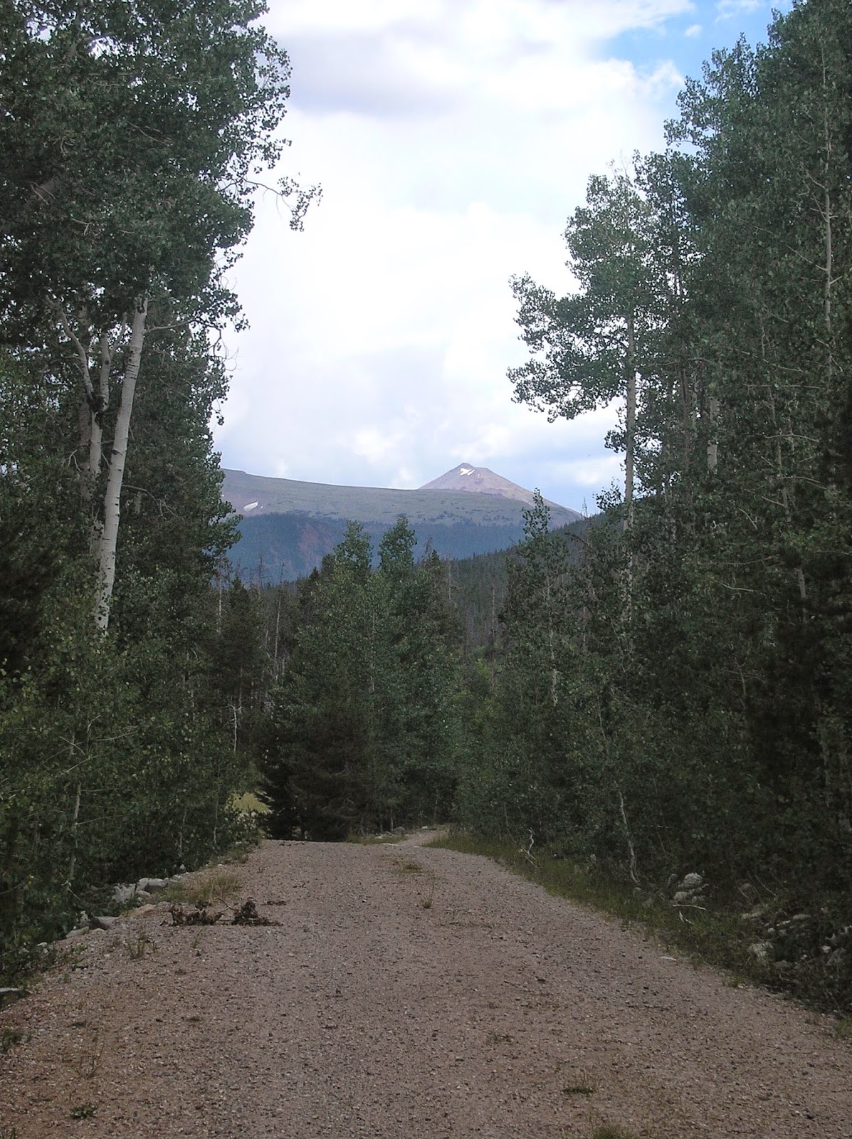 |
| A glimpse of A-1 and my destination from the forest service road that I had to hike on first. |
 |
| After already hiking 4-5 miles on the dirt road, seeing this relatively obscure trailhead was a little odd. Once I got around the little dirt hill there, though, the trail was fairly obvious. It didn't necessarily remain so throughout the hike! |
 |
| Recent deadfall completely covering the trail, which you can kinda sorta see running through the middle of this picture. |
 |
| The Uintas are not undergoing any additional uplift anymore; the only geologic activity they see is weathering and erosion. Because of this, this is what they look like; completely covered with scree, rocks and boulders, even at the lower elevation where it's mixed in with soil. |
 |
| Arrival at Hell Hole lake in a light rain. This is Kletting Peak; A-1 loomed even more impressively just to the left of this shot. |
 |
| A-1 Peak over the lake, with overcast skies and drizzle making the whole thing look rather washed out in pictures. Of course, the crappy cheap camera that I brought with me didn't help much there either. I was worried that I'd lose or break a better camera, so that's another significant regret. Should've brought a better camera. Oh, well. Yet another lesson learned. |
 |
| If this looks like a poor and uncomfortable campsite... well, it was. But least I didn't have to share it with any dead sheep. |
 |
| Kletting the next morning. This was about the point where I was 100% sure that I'd made for the wrong peak on the ridge. You can also see the small unnamed lake just below the patch of trees there. This is also the route that I should have taken up to the saddle between Kletting and A-1 (again; immediately to the left of this shot.) |
 |
| The false summit that I mistakenly believed to be Kletting for a while. |
 |
| Looking the other direction (mostly towards the north) you can see how steep the scree slope is and why it was so difficult to side-hill along a nearly 45° slope. |
 |
| Cliffing out trying to get back on track towards Kletting. I tried one more time to go up and over this cliff to get around it (rather than go back down and lose all the work that I'd done to get this far) but it was shortly after this that I realized that I was going to have to call it quits for the day if I was to stick to any reasonable facsimile of my original schedule. You can also see the route I should have taken and the small unnamed lake that should have been my guide-post even better in this pic. I actually didn't quit until I had gone up and come around above these cliffs. |
 |
| Coming straight down a 45° scree slope can be hazardous to your pants... |
 |
| Near the end of the second day's hike, almost back at my car, I had fresh run out of water and got to try out for the first time my UV water purification system on water from this here river. Ahhh. |
Thursday, October 2, 2014
Gear to replace
I like my lists, as you may (or may not) have noticed. Following my Uintas hike, I've now made a smaller list of gear that I need to replace, either because I did the Uintas hike without it, or because I did the Uintas hike with it and it didn't work as well as I'd hoped. Next summer--most likely, Sawtooth Mountains of Idaho with a friend of mine and some of his teenaged boys. I'll take my son with me, who'll be just shy of 14 years old by then; perfect age and size (presumably) to carry a real, full-sized backpack and gear. Of course, we'll be able to share some stuff--tent, stove, etc. but he'll need to shoulder nearly a full load of stuff just for him.
Need to be replaced
Need to be replaced
- Shoes. I don't really want to go back into the mountains without mid-height shoes. Besides, by nearly a year from now, my existing shoes will have significantly more wear and tear on them. Right now, probably looking at some Keen or Merrell $100 light hikers like the Moab Ventilator or the Kovens. If I'm OK spending a few bucks more, I might have a look at either some New Balance 703s or the Cabela's XPG Hikers.
- Sleeping bag. The bag I had was too light. Wasn't warm enough. I need to pick up something like a Kelty Cosmic Down bag.
- Camera. I didn't like the camera I used at all. I need a new one, or to at least bring one of our newer, better ones when I go. I'd like to have my own backpacking camera ideally, though.
- Compass. My compass got eaten/dissolved by a leaky DEET bottle. These are cheap, though.
- Permethrin. I'll need to retreat my clothes. My existing treatment's probably already worn off, or will be shortly.
- Map. Needless to say, my Wasatch and Uintas maps won't be much use in the Sawtooth Mountains.
Would LIKE to replace... but don't need to
- Stove. I don't have one. If I plan on cooking anything without mooching off the stove of my friend, I'll need to pick up a JetBoil Zip Cooking system. This also includes a fuel canister (sold separately) of course.
- A lighter and some kind of scrubbing pad. Cheap. No biggie.
- Pillow. I was quite uncomfortable. Inflatable pillows ain't cheap, though--the Exped Air Pillow is $40 bucks; $50 for the size I'd rather take.
- Tent. Although I wasn't unhappy with my tent, really... I'd still love to get something like a Eureka Midori 2, or the Cabela's XPG 2-person. Probably won't, though. Too much money. I do still need to outfit my son too, after all.
Monday, September 29, 2014
Gear experiments
Before I post details of the actual hiking in the Uintas that I did, I thought I'd take stock and talk about some of my "gear experiments" and how well they worked--or didn't.
- Cheap vs. expensive specialty. For the most part, I avoided expensive specialty gear from pricey brand-names like Mountain Hardware, REI, First Ascent, Marmot, etc. I bought my backpack in the Meijier sporting goods section for $50 fer cryin' out loud. My conclusion, primarily, is that brand doesn't matter. I was perfectly happy with my pack, my headlight, my sleeping pad, etc. even though they cost only a fraction of the expensive gear recommended by Backpacker Magazine (who, of course, pays their bills by advertising for backpacking gear suppliers.) There were, however, a few notable exceptions.
- 50L backpack plus a "fanny pack" for items I wanted to have more on hand--a lot of folks will tell you that a 50L pack for a longish expedition is pretty small. I did OK, though--and I really liked the fanny pack addition to keep stuff handy. I will admit that if I'd been backpacking in an area where I needed a bear canister, I'd probably have been in trouble without a 65-70L pack, though. I kept my needs a little light by never planning on spending more than 4-5 nights out without returning to my car and moving to a new trailhead--conveniently reloading my pack while I'm at it.
- Permethrin treated clothes. Not sure. I didn't get bit by any mosquitoes or ticks, certainly, but that may well be because I was there when the mosquito season was more or less over, too. I'd like to try this experiment again. I brought some 100% DEET spray in a pump bottle as a backup. It ended up leaking in my pack and ruining some of my gear, by essentially starting to dissolve and destroy the plastic. I'm not keen on bringing more again. I'd also like to get the "real" Permethrin treated clothes; the way that bug-proof clothing actually does it, instead of the backpackers permethrin, which wears off quickly.
- No cook food. I'd make a few changes to my food, but not many. This worked out well. I was certainly tired of eating the same stuff day after day, but then again, I appreciated not having the weight of a backpackers stove, or worrying about having to prepare anything. Most likely I will by a Jetboil Zip cooking system before I go backpacking again, but not because this particular experiment was a failure.
- Lightweight sleeping bag with hat and base layers. This didn't work out as well as I'd hoped. Not because the concept is bad, but because I should have known that a 40° bag for $35 that actually performed as advertised was too good to be true. I was cold every night; at least a little. Next time around, I'll pick up a Kelty Cosmic Down sleeping bag--about the cheapest of the "nice" sleeping bags, and use that. It'll probably take up a little bit more space, but not much, luckily. Having a small sleeping bag is an important consideration. Speaking of sleeping well, I'll also bring sleeping pills and some kind of inflatable pillow. The worst part of my trip was not sleeping as well as I'd want, and not feeling rested the next day. Without that, I could have had fun for several more days than I actually ended up doing.
- Athletic shoes instead of hiking boots. This was another mixed success. For the most part, I enjoyed having lightweight, comfortable shoes that didn't need any breaking in. However, it's important to note that this hiking advice was developed in the Pacific Crest Trail by through-hikers. The PCT is famously a smooth, easy trail for walking on. The Appalachian Trail, by contrast, is notoriously rocky, which leads to more sore feet if the soles of your shoes aren't sufficiently hard, and more possibility for turning or twisting an ankle in low-cut shoes. Start wandering off-trail, especially in a place like the Uintas where above tree-line has a mass of loose rocks, and your possibility for an ankle injury goes up dramatically. I spent some time on steep scree slopes, and I did not feel secure in my ability to withstand ankle injuries. My shoes ended up being a limiting factor that contributed to my lack of success (and later, lack of attempts) on any of the summits in the Uintas. Of course, it's not a false binary--$35 athletic shoes at J.C. Penny's (what I ended up spending) or $300 Asolo boots, of course. For my next excursion, I'd like to split the difference, and get some high-top hiking shoes of an athletic variety. I mentioned earlier some Cabela's XPG mid-hikers as a strong contender for what I'd like. New Balance also has some that are about the same price, and another pair that are even cheaper (albeit also lower--but probably high enough to protect my ankles if they start to roll a little.)
- I'm also going to ditch the rain pants. I didn't get any really hard rain, but even if I had, I think the Frog Toggs jacket would have been sufficient. My hiking clothes are sufficiently quick drying that I'm not worried about sitting around wet and catching hypothermia or anything like that. To be honest with you, I didn't even use the jacket except for a brief moment the first day--it was sprinkling when I started out. I ended up putting the jacket away after about 45 minutes or so of walking and never got it out again, even when I got caught in some other rain storms. But like I said, I never ended up hiking in any really strong, hard rain either.

Monday, September 22, 2014
Chimney Rock and Scott's Bluff National Monument
Last time I posted, I was all packed and ready to go. I've now been back home for almost a month. Time to start talking a bit about my trip!
I road-tripped to the Rockies from my home in the northern Midwest. One advantage to this was that I could see things on the way. I stopped for the first night of driving in mid-Nebraska. It occurred to me that if I got off the interstate, I wasn't really going very far out of my way to see Scott's Bluff; a location I'd always wanted to see both because it's kinda fun and scenic, and because it's historical, as a pivotal location on three pioneer trails; the Oregon Trail, the California Trail and the Mormon Pioneer Trail. Not only did I stop at a few historical markers in Hwy 92 (namely Ancient Bluff Ruins and the Brigham Young North Platte River crossing site) but what I really stopped for and got out and walked a bit were at Chimney Rock and the National Monument itself. Chimney Rock doesn't have any maintained trails, but there is a small visitor center. If you continue past the visitor center to the small dirt road to the right, you can go to a small turnaround, where there is a use trail (i.e., not maintained, but developed by persistent use) that heads to the base of the monument.
I didn't follow this trail all the way to its conclusion. Not expecting it to be there, I wasn't really dressed for it, namely I was wearing shorts and the trail is thin and marches through unmowed thick prairie grass. I did walk far enough to take some pretty decent pictures of the rock itself, and it looks like it continued all the way to the base of the rock were there is a small marker or some sort. I'd really like to get back to the spot again (maybe with my family; showing them some history as well as some scenery to boot is always a worthwhile activity, right?) and walk all the way up to the marker, at least. Just need to remember to wear long pants!
My stop at Chimney Rock and Scott's Bluff National Monument was a bit constrained; although I started the morning pretty early, I had to finish this part of the trip and get back on the interstate before it got too late, because I was due at my sister-in-law's house later in the evening on the eastern end of the Uinta Mountains. If I'd had long pants, I would have walked at least as far as the small marker you can see in the image above, but I didn't, so I turned around and came back quickly to I could proceed a few more miles into Gering, NE and from there to the Monument.
Scott's Bluff National Monument is relatively small. There's a road that runs straight through it, and a small visitors' center. From there, you can park your car and hike up to the top of the bluff itself, where there are a few smaller loop trails. Or, if you're in a rush, you can drive up to a parking area near the top of the bluff and take the loop trails from there. Because I was concerned about time, I drove to the top, but as it turned out, I hiked almost all of the way down the trail and back up again. Next time around, I'll probably not even bother with driving to the top.
Either way, you can see most of what there is to see in just a couple of hours or so. Scott's Bluff is not a pristine wilderness, it's a few hiking trails on a large rock formation next to two small but attractive little towns, surrounded by a vast sea of prairie. From the top, you can easily see Gering and Scottsbluff, the two towns, as well as the North Platte River, a few other more distant rock formations (including Chimney Rock), and on extremely clear days, some of the distant mountains of Wyoming across the border.
The hike up the side of the monument is a scenic one, you get to see the saddle from up close, and you get to walk along a trail that hugs the sheer sides of the bluff too. There is a small pedestrian tunnel that bores through the monument. The early part of the hike is thus on the south side, but it finishes up on the north side. It doesn't end at the parking lot, but rather at a far extremity of the north loop hike on the top.
After this, I drove to Vernal, UT, which was pretty fun too. I was on the interstate most of the time, but got off to drive through Flaming Gorge to get to Vernal. You can't go to Vernal and not look at some dinosaurs. I didn't go to Dinosaur National Monument (although I'd love to on another trip sometime!) but I did see the dinosaur museum in Vernal itself.
The national monument straddles the Utah/Colorado border and is actually better known as a scenic destination than one that's really all about the dinosaurs. It was uplifted in the same orogeny that created the Uintas (although the origin of the rock itself is different, it's usually considered the far eastern vanguard of the Uinta Mountains).
Although in spite of that, of course, a number of very productive fossil beds have been found in the area.
I road-tripped to the Rockies from my home in the northern Midwest. One advantage to this was that I could see things on the way. I stopped for the first night of driving in mid-Nebraska. It occurred to me that if I got off the interstate, I wasn't really going very far out of my way to see Scott's Bluff; a location I'd always wanted to see both because it's kinda fun and scenic, and because it's historical, as a pivotal location on three pioneer trails; the Oregon Trail, the California Trail and the Mormon Pioneer Trail. Not only did I stop at a few historical markers in Hwy 92 (namely Ancient Bluff Ruins and the Brigham Young North Platte River crossing site) but what I really stopped for and got out and walked a bit were at Chimney Rock and the National Monument itself. Chimney Rock doesn't have any maintained trails, but there is a small visitor center. If you continue past the visitor center to the small dirt road to the right, you can go to a small turnaround, where there is a use trail (i.e., not maintained, but developed by persistent use) that heads to the base of the monument.
I didn't follow this trail all the way to its conclusion. Not expecting it to be there, I wasn't really dressed for it, namely I was wearing shorts and the trail is thin and marches through unmowed thick prairie grass. I did walk far enough to take some pretty decent pictures of the rock itself, and it looks like it continued all the way to the base of the rock were there is a small marker or some sort. I'd really like to get back to the spot again (maybe with my family; showing them some history as well as some scenery to boot is always a worthwhile activity, right?) and walk all the way up to the marker, at least. Just need to remember to wear long pants!
 |
| Chimney Rock approach. I didn't have any camera batteries, sadly, at the time, so I had to take pictures with digital zoom on my phone, which are poor quality. Sorry! |
 |
| The scenery behind the rock. |
 |
| More scenery behind Chimney Rock. If you panned your view about a quarter turn to the right, Chimney Rock would be more or less centered directly in front of you. |
 |
| Chimney Rock while approaching it on foot. |
 |
| Closer up view. You can just see the small marker at the base of the rock. Unfortunately, as I said above, I didn't get much closer to it than this. |
Scott's Bluff National Monument is relatively small. There's a road that runs straight through it, and a small visitors' center. From there, you can park your car and hike up to the top of the bluff itself, where there are a few smaller loop trails. Or, if you're in a rush, you can drive up to a parking area near the top of the bluff and take the loop trails from there. Because I was concerned about time, I drove to the top, but as it turned out, I hiked almost all of the way down the trail and back up again. Next time around, I'll probably not even bother with driving to the top.
 |
| The entrance. |
 |
| Mormon handcart replica. |
 |
| Famous view of Eagle Rock and the wagon replica. |
 |
| Eagle Rock and a different wagon. |
 |
| The wagon, but instead of Eagle Rock the slightly more distant Scott's Bluff itself... |
The hike up the side of the monument is a scenic one, you get to see the saddle from up close, and you get to walk along a trail that hugs the sheer sides of the bluff too. There is a small pedestrian tunnel that bores through the monument. The early part of the hike is thus on the south side, but it finishes up on the north side. It doesn't end at the parking lot, but rather at a far extremity of the north loop hike on the top.
 |
| At the Visitor Center looking at Mitchell Pass |
 |
| Climbing the bluff on the hiking trail, you can see views like this. |
 |
| Approaching the saddle on the trail. |
 |
| The rocks of the saddle. This is as close as you can get to these rocks without ignoring the signs and the rangers and pressing on across the top of the rocks. I didn't elect to do that. :) |
 |
| On the north side of the bluff trail. |
 |
| South side summit views. with a clear view of the tunnel that bores through the bluff for the hiking trail. |
 |
| Visitors center from the south summit loop. |
 |
| North side summit loop. I tried to catch a hawk in flight here, but I missed. Still, a nice view. |
 |
| Further north side summit view. |
 |
| The actual summit marker. |
The national monument straddles the Utah/Colorado border and is actually better known as a scenic destination than one that's really all about the dinosaurs. It was uplifted in the same orogeny that created the Uintas (although the origin of the rock itself is different, it's usually considered the far eastern vanguard of the Uinta Mountains).
Although in spite of that, of course, a number of very productive fossil beds have been found in the area.
 |
| My niece in front of a Stegosaurus skeleton. |
 |
| Allosaurus fragilis. Always one of my favorites. And part of my niece's head... |
Wednesday, August 6, 2014
All packed!
Except food and water. Lacking anything other than a bathroom scale to weigh it, I weighed myself without the pack, then put the packed up pack on, then added the fanny pack. Got a base pack weight of 15.8 lbs, which sounds really pretty good, especially considering that I cut a lot of costs by not buying super expensive ultralight stuff, like a really lightweight, great tent, etc.
But the fanny pack was an additional 3.2 lbs. Combined total base pack weight--and I think it's only fair to combine them--is 19.0 lbs. Not exactly ultralight, but certainly lightweight compared to the crazy pack weights we used to haul around as teenagers. I'm not unhappy. I had estimated a total of 16.5 lbs, but I added a few minor items, and ended up using small bungee cords to hold the sleeping pad in place. I could have cut off some paracord and saved some weight there, but it's not worth the effort.
I could also shave a little weight by getting rid of a few things--the fanny pack could be repackaged inside the backpack, saving the fanny pack weight. I could ditch the SteriPEN and camera cases. I could probably ditch the tarp.
But frankly, I think the fanny pack concept is too convenient. So what if it adds a pound or so? Totally worth it to have stuff readily and easily available without having to stop, take my pack off and dig through the side pockets.
But the fanny pack was an additional 3.2 lbs. Combined total base pack weight--and I think it's only fair to combine them--is 19.0 lbs. Not exactly ultralight, but certainly lightweight compared to the crazy pack weights we used to haul around as teenagers. I'm not unhappy. I had estimated a total of 16.5 lbs, but I added a few minor items, and ended up using small bungee cords to hold the sleeping pad in place. I could have cut off some paracord and saved some weight there, but it's not worth the effort.
I could also shave a little weight by getting rid of a few things--the fanny pack could be repackaged inside the backpack, saving the fanny pack weight. I could ditch the SteriPEN and camera cases. I could probably ditch the tarp.
But frankly, I think the fanny pack concept is too convenient. So what if it adds a pound or so? Totally worth it to have stuff readily and easily available without having to stop, take my pack off and dig through the side pockets.
 |
| The corner of my room looking a bit more organized... |
Subscribe to:
Posts (Atom)